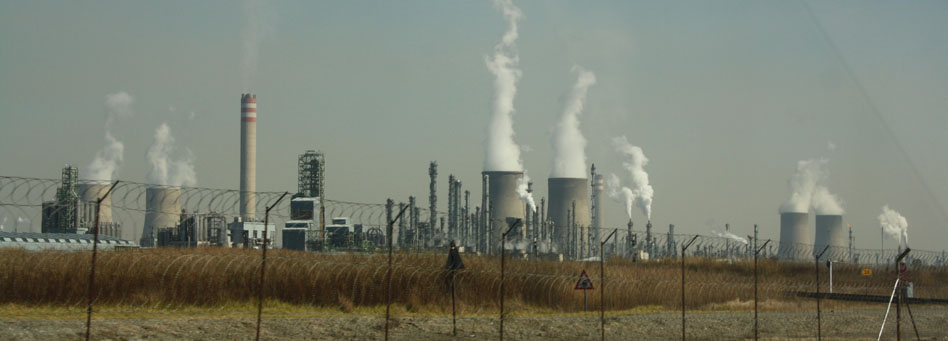
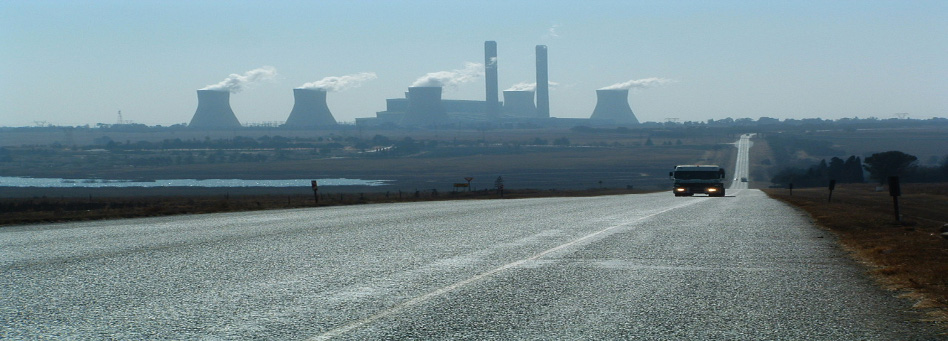
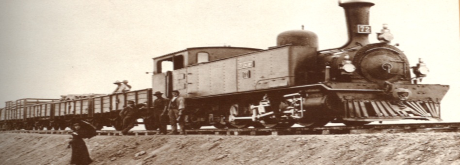
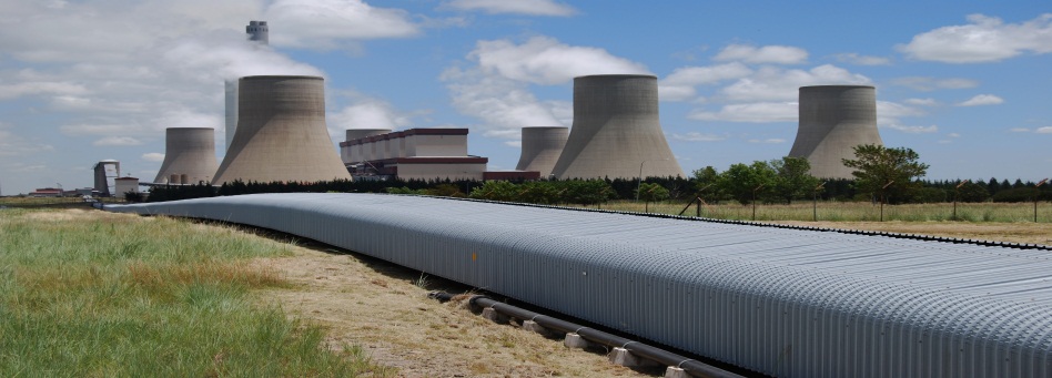

Rail Featured Images Ermelo yard. DC Electric locomotives

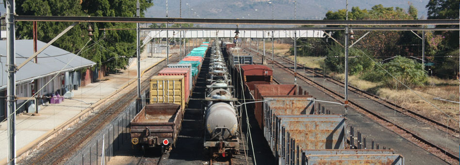
Rail Featured Images Trichardt yard with train

Rail Featured Images Test vehicle at Waterval Boven

Rail Featured Images Douglas Colliery loading coal
Railway lines in Mpumalanga are dissected by various provincial borders and as such, do not form end to end corridors within the provincial borders themselves.
- Pretoria - Balmoral - Witbank - Komatipoort (the Maputo Corridor)
This 383 km section of the Maputo Mainline is part of the through 566 km route between Maputo and Pretoria and falls within the borders of the Mpumalanga between a point near Balmoral in the west and the South African border at Komatipoort in the east. This has for many years been a busy general freight route for both international and domestic traffic. Because of the steep grades on the direct line between Pretoria and Witbank, most heavy traffic from the west and destined to Richards Bay is routed around Pretoria to Sentrarand yard and then to Ogies via the more easily graded section from Welgedag. The steep descent from Waterval Boven to Waterval Onder is also an operating constraint for traffic on the route but there is, nevertheless, significant spare capacity over the route.
The route from Maputo to the interior has always been an important import/export route, although the turbulent years in Mozambique from the 1970's to the 1990's disrupted most international traffic. Most fresh fruit traffic from the Lowveld to Gauteng is now taken by road but a portion of export traffic to Maputo is on rail. A major effort is being made by Nelspruit promoters to regain lost traffic. Coal and sugar, as well as container traffic is increasing and future years could see cross-border traffic increasing from a mere 300 000 tons per annum at present to over 4 - 5 million in the future. The line is a single track route and is electrified utilising the 3 000 DC system (3 kV) from Komatipoort to Witbank and beyond towards Pretoria. Diesel traction is used in Mozambique.
The railway was opened to Pretoria in 1894, having been started from the Komatipoort end in 1891. The story of the construction of this railway, particularly the Lowveld section to Waterval Boven is one of great interest, with Malaria being responsible for the deaths of countless workers. The completion of the line was filled with political intrigue, since the old Transvaal Republic wished to have its own independent rail outlet to the sea - not one controlled by British interests. Because of this, construction of the two British controlled lines from Durban and Cape Town were halted at the border in an attempt to allow the Maputo - Pretoria line to be opened first. However, the line from the Cape via the Free State was opened from the Vaal River to Germiston and Pretoria in 1893, pre-dating the Maputo route by a year.
There are four important branch lines which feed traffic to the mainline along this route. The Roossenekal branch generates iron ore traffic destined to industries in the Witbank area, while titanium is railed to Newcastle in KZN. The Steelpoort branch generates chrome and ferrochrome traffic, as well as Andalusite for export at Richards Bay. In the Lowveld region, the branch lines to Graskop, Plaston and Barberton serve major forest plantation areas which generate over 500 000 (down from 750 000 in 2005) tons of timber traffic routed to the large paper mill at Ngodwana, to Richards Bay, Gauteng, the North West and Free State. All this traffic is routed over the mainline, as is the substantial phosphate rock traffic from Phalaborwa to Richards Bay.
- Kaapmuiden - Mica and beyond to Tzaneen and Groenbult
This 384 km route originally ran from Komatipoort through the present Kruger Park to near Newington. First proposed as a private railway to the Murchison Gold Fields in the early 1890's, its construction was filled with business intrigue which ultimately delayed its completion to Newington by 1910. Absorbed into the State-owned SAR shortly thereafter, it was extended north to Tzaneen in 1912, and to Soekmekaar in 1915. The latter extension changed its status as a branch to that of an arterial line, providing a link with the mainline between Pretoria and the Zimbabwe border. The southern end of the line was deviated to avoid the Kruger Park in 1971 and electrified. This change took place because of the development of mining activity at Phalaborwa and the desire to export copper and rock phosphate, first via Maputo and later via Richards Bay on the completion of the through Swaziland route in 1986.
The line handles over 1.8-m tons of rock phosphate traffic, as well as traffic between Richards Bay and Beit Bridge, to and from points north. This traffic is routed over the Pretoria - Komatipoort mainline between Kaampuiden and Komatipoort from where the line continues to Swaziland. There is also export fruit traffic from the Lowveld in Limpopo Province to Maputo.
The line is electrified at 3 kV and operated by CTC between Kaapmuiden and Phalaborwa. Diesel traction is used to Tzaneen and Groenbult-junction of the Polokwane - Beit Bridge section of the mainline from Pretoria. The 65 km section from Kaapmuiden to Hazyview and Mkhuhlu falls within Mpumalanga Province
- Komatipoort - Swaziland border and south to Richards Bay
This line was opened during February 1986, creating a through link with Swaziland Railways via Mananga on the border of both countries and Richards Bay. In Swaziland itself, a new line from Mpaka was constructed northwards to close the link. This provided a direct route for phosphate rock exports from Phalaborwa to Richards Bay. Some 70 km of line is in Mpumalanga. The line is single track and powered by diesel traction.
- Machadodorp - Breyten - Ermelo (and beyond to Vryheid)
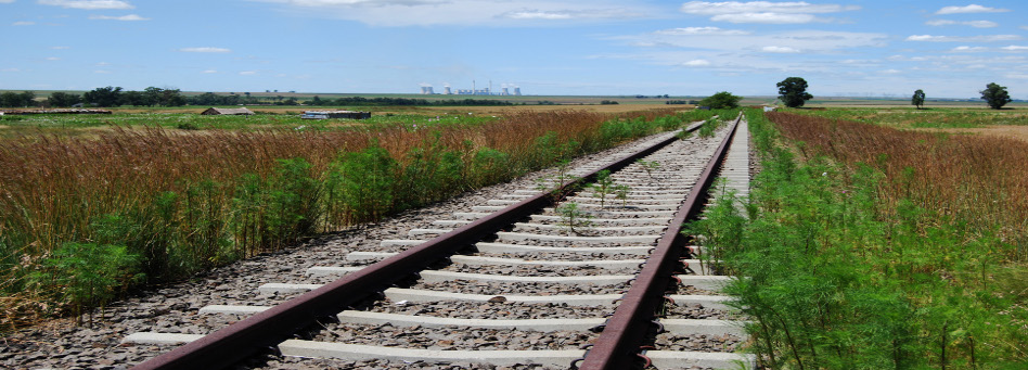
This secondary arterial route was opened in 1908 from Machadodorp to Breyten, where it connected with a line from Ermelo which had been opened from Springs in 1905 - 07. It was then extended southwards to Piet Retief in 1911 and Vryheid in 1913. The Ermelo to Vryheid section, completely rebuilt to a heavy-haul standard during the mid-1970's, is now part of the Richards Bay coal line. Of the original total length of 367 km, some 297 km is within Mpumalanga. The provincial border is south of Commondale and with the reconstruction of the line in the 1970's, the total length was reduced by several kilometres. The section between Ermelo and Machadodorp has not been reconstructed although the line has been upgraded in recent times. Diesel traction is used over the line.
Traffic on the Ermelo - Machadodorp section consists mainly of coal which is railed from three on-line collieries. Some 2.6-million tons of coal is railed to Richards Bay, while 130 000 tons is directed to Maputo. Coal is also railed to domestic users in KwaZulu Natal and for export at Wests (in Durban). Forestry traffic is generated in the Carolina area, as well as from the Lothair branch. The volume is some 300 000 tons per annum, directed to paper mills at Ngodwana and Geduld (Gauteng) as well as to Richards Bay, Mandini and to the mines in the Free State and North West Province.
- Witbank - Ogies - Welgedag - Apex
This line is 122 km long, of which the 82 km Witbank to Eloff section lies within Mpumalanga. It is used mainly for coal traffic originating in the Witbank area and directed to various destinations in Gauteng, Free State, North West and beyond. A significant portion of coal traffic is diverted at Welgedag to freight by-pass lines and Sentrarand yard, to avoid congestion in the busy Gauteng Metro area.
The line is electrified at 3 kV, and is double track throughout. Train control is by way of Centralised Traffic Control (CTC). Both vacuum and air brake trains operate on this relatively level line. Block loads of coal generally are loaded to 50 or more air-braked wagons.
Coal traffic for Richards Bay is generally routed from various loading points to Ogies and Ermelo. There is also important transit coal, chrome, ferrochrome and granite traffic routed from the North West over the line from Sentrarand yard and Welgedag to Ogies. There is, in addition, substantial silica traffic loaded at Delmas and grain traffic generated at various points along the route.
Additional coal is forwarded to important domestic destinations, including Palmford - located between Standerton and Volksrust. Over 7 million tons of coal is currently being railed to a power station near this point because the supporting colliery developed major geological problems and cannot be used. A plan has been put forward by ESKOM to construct a new railway from a point between Bethal and Ermelo to the plant since some 12 million tons of coal traffic is currently on road over this route. The railway administration has revealed that this will be a 68 km heavy haul line and that the estimated cost of construction will be R 1.45-bn.
- Ogies and Wonderfontein - Broodsnyersplaas - Ermelo - Commondale section of the Richards Bay Coal line
The 54 km Ogies - Broodsnyersplaas section was opened between 1946 and 1950 to serve new coal mining development in the area. The line was extended to Ermelo as part of the Richards Bay Coal line during the mid-1970's, while a new line from Wonderfontein was built to Broodsnyersplaas, forming a "Y" shaped line.
There are major coal producing mines along the line between Ogies, Saaiwater and Broodsnyersplaas. A number have Rapid-loading facilities. Export coal from mines on the Apex - Witbank line is routed to Ogies and along the line to Ermelo. Substantial volumes of coal are generated at two stations on the Wonderfontein section, which is also used for ferrochrome traffic. Both lines are electrified at 3 kV dc and train control is by CTC from Ermelo. Coal trains make the switch to AC locomotives at Ermelo.
- Springs (Gauteng) - Bethal - Ermelo and Estancia
This line is 198 km long and serves the Mpumalanga Highveld agricultural area. 151 km of the line falls within Mpumalanga and the balance within Gauteng. Since the opening of the Richards Bay coal line, the original route from Davel to Breyten has been truncated at Estancia and through traffic is now routed over the coal line to Ermelo. The line provides a strategic route for traffic from the synfuels plant at Secunda, as well as forestry traffic from eastern Mpumalanga.
The line is only electrified over the heavy-haul coal section between Davel and Ermelo, and is operated with diesel locomotives stationed at Springs. The line is single track and signalling is controlled by the Van Schoor tablet system. On normal days, five trains are operated in each direction daily and apart from bulk liquids originating at Secunda (via Trichardt station), pulpwood traffic from the Lothair area is routed via Springs to the large paper mill at Geduld.
- Union - Volksrust and Durban (KZN)
Just 176 km of the important 771 route km on the Germiston - Durban main line falls within the present-day Mpumalanga. This is the section from between Spruitrus/Fortuna and Volksrust. The line is electrified at 3kV dc, is double track throughout and controlled by CTC from Standerton.
Most traffic on this route is long-haul transit between Gauteng, Newcastle, Cato Ridge and Durban. Major volumes recorded during the 2007 - 2008 review period included 2 million tons of iron ore from the Northern Province to Newcastle and 1.7 million tons of containerised traffic from Gauteng to Durban. In the opposite direction, there was 1.3 tons of containerised traffic and nearly 900 000 tons of liquid fuels originating from Durban. Some 200 000 tons of iron or steel products were forwarded to Gauteng from Newcastle. Local generated traffic, which was virtually all agricultural and which included that from the Grootvlei line and the Vrede branch amounted to less than 23 000 tons. Over 12 million tons of transit traffic in both directions and about 7.4 million tons of coal were railed to a power station near Palmford, between Standerton and Volksrust.
The railage of coal to this power station came about because the supporting colliery experienced geological problems and was forced to stop mining. A plan has now been put forward to construct a new railway from a point between Bethal and Ermelo to the plant, since some 10 - 12 million tons of coal traffic is currently on road over this route. The railway administration has revealed that this line will be a 68 km heavy haul operation and that the estimated cost of construction will be R 1.45-bn.
- Bethal - Morgenzon - Volksrust
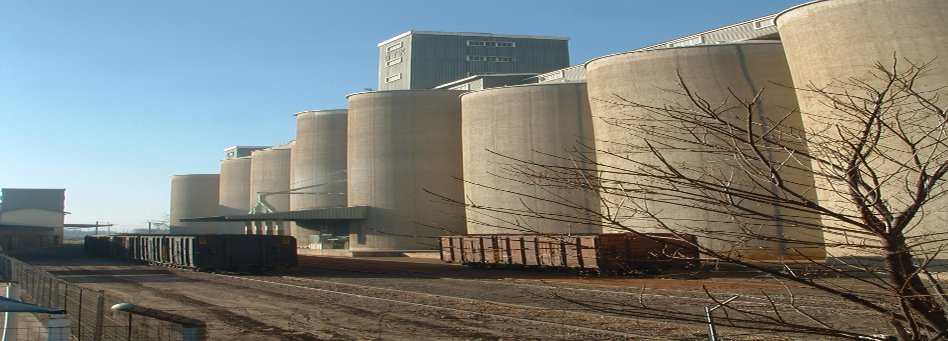
This 170 km route was opened for agricultural development between 1914 and 1916. There are several large grain silos along the line but the route is currently not operational. Because of this, grain traffic has been forced to road and export opportunities have become limited. The future of this line must be determined as soon as possible. Already, stations have been vandalised and rail has been removed. This is a matter of great concern.
- Balfour North - Grootvlei - Bethlehem (Free State)
This interprovincial secondary route serves agricultural areas in both Mpumalanga and the Free State. Of the total 212 km length, some 46 km between Balfour North and the crossing of the Vaal river north of Villiers falls within Mpumapanga. With the demise of general freight traffic, it's main purpose today is to handle seasonal grain traffic originating at grain silos along the route. In a typical week, one to two trains are operated from Standerton, but on an ad-hoc basis.
The line links with another running from Redan at Grootvlei. This line, also partly within Mpumalanga was originally constructed to move coal and to serve the ESKOM Grootvlei power station, currently out of use but anticipated to be reopened as part of the plan to re-open several power stations in storage. This may result in new traffic, particularly coal traffic in the future.
- Kaapmuiden - Barberton
A 56 km line, opened in 1896. As such, it was the first branch line to be constructed in present-day Mpumalanga. The main traffic for many years was general freight including supplies to the mines in the area. This has now changed and the branch serves the forestry industry which has developed large plantations along the Badplaas road.
During the 2007 - 2008 review period, 174 048 tons of traffic was originated at three loading points on the branch. This was down from 290 485 tons in 2004-5. Barberton generated 111 528 tons which included a substantial volume of mine prop timber to the Free State and North West. Pulpwood was directed to mills at Ngodwana, Richards Bay and Mandini. There was no inbound revenue-earning traffic.
- Nelspruit - Graskop and Plaston
This is another branch serving the forestry industry. It was opened in 1913 between Nelspruit and Sabie, a distance of 90 km. The branch was extended to Graskop (124 km) in 1914. Another short branch was opened in 1926, running from Citrus to Plaston, a distance of 29 km. Both these branches run through very hilly and mountainous country and are steeply graded.
In spite of this some 147 993 tons of forestry traffic was forwarded from four loading points along the line during 2007-2008. All this traffic was delivered to the mill at Ngodwana, In the past, a substantial tonnage was sent to various mills and chipping plants at Richards Bay. Mine prop timber was another important traffic generator. Major forest fires devastated the area in 2008 and it will take many years for the pine plantation to recover from this disaster.
Inbound received traffic is increasingly important. Over 146 000 tons of liquid petroleum products were received at Rocky Drift on the Plaston branch, sent from Durban and Trichardt.
- Buhrmanskop - Lothair
Running eastwards from Buhrmanskop on the Machadodorp - Ermelo line, this 50 km branch was opened in 1925 as an agricultural development line. In recent years it has increasingly served the forestry industry as plantations have been developed along its length. During the 2007 - 2008 financial year of the railway administration, over 276 000 tons of forestry traffic originated on the branch. This is down from 400 000 tons three years earlier. Of this amount, only about 60 000 tons (down from 250 000 tons) was destined to Richards Bay. In addition, a small volume of maize, but no longer beans and stock feed traffic, originated on the branch. No revenue-earning traffic was received.
Many proposals have been made in the past to link this branch with Swaziland. This became a matter of great interest and debate after the construction of a railway from Mozambique to the iron ore mine at Kadake in the mid-1960's. A link with Lothair would have been just about 50 km in length to the border but the fact that the branch was constructed to a light standard and would have to be completely rebuild discouraged this proposal. In addition, the new link with Swaziland by way of Komatipoort provided an alternative much supported by the South African railway administration. This issue has been revived in recent years and discussions over implementation are on-going.
Copyright © 2010 Mpumalanga Province Freight Transport Data Bank [ - ]
All rights reserved.
This website conforms to W3C Standard [ - ]