The best performing district municipality of the 21st century.
» MissionEhlanzeni District Municipality strives to excel in planning, coordination and support for our Local Municipalities in consultation with all stakeholders to ensure the best standard of living for all.
»Core ValuesEhlanzeni is guided by the following values in conducting its business:
- Transparency
- High Quality Service Delivery
- Accountability
- Service Communities with Integrity
- Efficiency
- Professionalism
EDM derives its mandate and goals from Section 84 (3) of the Municipal Systems Act of 1998 which states that a district municipality must seek to achieve the integrated, sustainable and equitable social and economic development of its area as a whole by:
- ensuring integrated development planning for the district as a whole;
- promoting bulk infrastructural development and services for the district as a whole;
- building the capacity of local municipalities in its area to perform their functions and exercise their powers where such capacity is lacking; and
- promoting the equitable distributoion of municipalities in its area to ensure appropriate levels of municipal services within the area.
In addition to the above, the district has the following goal that forms part of its strategy of ensuring that the aforementioned mandate and goals are achieved.
- Building a modern and performance driven municipality.
The figure below summarises the power and functions of EDM.

Ehlanzeni District Municipality reviewed its organisational structure, which was approved by the Municipal Manager and adopted by Council, making it possible for the municipality to meet all the requirements of its legislative mandate as well as deliver on services in line with the IDP. The Figure below shows the top-layer organizational structure of Ehlanzeni District Municipality. This structure is streamlined according to the key focus areas of local government (basic service delivery; financial viability and management; local economic development; institutional transformation and development; and public participation and good governance) and includes transversal or special programmes namely youth development, support for people with disabilities, HIV/Aids, women, and economic empowerment of previously marginalised groups.

EDM Organogram
EDM Political Leadership And Administrative Structure

EDM Organogram
Office of the Municipal Manager

EDM Organogram
Office of the Municipal Mayor
Ehlanzeni District Municipality (EDM) is one of the three district municipalities located in the north eastern part of Mpumalanga Province. EDM is bordered by Mozambique and Swaziland in the east, Gert Sibande District in the south, Mopani and Sekhukhune Districts of Limpopo in the north and Nkangala District Municipality in the west.
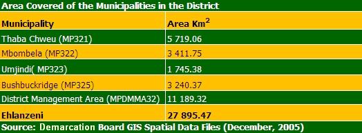
The municipality comprises of five local municipalities namely: Thaba Chweu, Mbombela, Umjindi, Nkomazi, and Bushbuckridge's 2 local municipalities. EDM also comprises a District Management Area (DMA) in the southern part of Kruger National Park. With the incorporation of Bushbuckridge into Ehlanzeni the total area coverage of the district is approximately 27,895.47 Km squared. The map below shows a map of South Africa and the location of Ehlanzeni in Mpumalanga Province.

EDM is based in Nelspruit the provincial capital of Mpumalanga. Its main route the N4 Maputo corridor transverses the district from the east of Maputo harbour - that is in Mozambique - through Gauteng province to the North-West Province in the west; and the R40 Maputo sub-corridor transverses the district from Barberton in the south linking Swaziland to Phalaborwa that is Limpopo Province in the north.
The table below presents the area coverage of the municipalities in the District.
Population Size
The distribution and characteristics of the population of an area play a significant role in the ability of the area to deliver basic municipal services. EDM has a population of 1,526,236 (Statistics SA 2007) which is approximately 42% of the total provincial population of 3.6 million in Mpumalanga (MPGDS 2008).

According to the Provincial Integrated Spatial Framework, Ehlanzeni area has the largest population with an urbanisation level of 17%. Nelspruit, Nsikazi, Barberton, White River and Mhala are the biggest urbanised areas in Ehlanzeni district. The administrative capital of the province is Nelspruit, which is found in this area. Service centres in this area are Barberton and White River, with a diverse economic base and a strong focus on the agricultural sector. Other service centres in the Ehlanzeni area are Nkomazi, Mapulaneng and Lydenburg. The tourism and forestry centres include Sabie, Graskop, and Pilgrim's Rest.
Population Growth Rate
The population of Ehlanzeni increased by 5.47% between 2001 and 2007 (i.e. the population grew from 1,447,053 to 1,526,236).
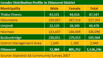
The table above shows the gender composition in Ehlanzeni, consisting of 53% or 805,752 females and 47% or 720,484 males; and representing a male/female ratio of 89 males for every 100 females, which poses a social challenge in the district and impacts on service delivery. Although there is migration by both genders to other provinces, this can not be a true reflection of the real extent of migration because the province is also host to many migrant workers from other provinces.
Racial Profile
The racial distribution of the people is a significant feature that impacts on delivery of services. Almost 94.4% of the people of Ehlanzeni are Black African who do not have access to sufficient services. The remainder of the population consists of Indian or Asian (0.3%), Coloureds (0.5%), and Whites (4.7%).

The percentage distribution of households per income group confirms the role of affordability in the planning and budgeting of service delivery. According to the Stats SA Community Survey in 2007 49.2% of the households did not have any income, 23.9% earned incomes between R1 to R400, and 10% earned between R 801 to R1, 600 per month (Table 3). The comparison between periods and when this survey was conducted clearly shows an increase in the number of households in the lower income levels, a decline in the income groups to having no income. This indicates the impact of unemployment and the fact that many initiatives to alleviate poverty have not yet yielded the desired results in changing the conditions of the poor.
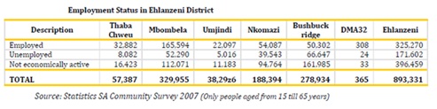
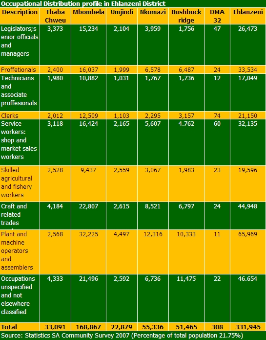
Employment in the district includes those people who are formally and informally employed. The economically active catagory comprises all people with the capacity to be employed in the economy and it includes both the employed and unemployed. Table 4 above shows that Ehlanzeni had 44.4% of not economically active participants in the economy. Factors that contribute to this include the increase in the population of the working groups (migrant workers, number of graduates, matriculants, school drop outs, retrenchments, etc). This resonates with the previous section on household incomes that had decreased as a result of an increase of the unemployment rate. Figure 17 also indicates that 36.4% of the labour force was employed and 19.2% unemployed.
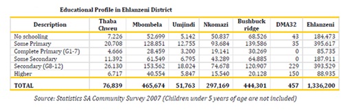
The level of education composition reveals relatively low levels of schooling in the district. Only 6.7% of the opulation has higher education and 29.5% secondary schooling. This highlights the pressure on delivery training and educational services, ranging from pre-school level to tertiary level not only in the district but the province as well. There is a great need in the province to have a university and more tertiary institutions to improve the state of education.

- Mbombela Local Municipality
- Bushbuckridge Local Municipality
- Nkomazi Local Municipality
- Thaba Chweu Local Municipality
- Umjindi Local Municipality
Ehlanzeni District
- Municipality Moto: Amadokwe, Amabele, Avuthiwe
- Municipal Demarcation Board Code: DC32
- Head Office: Nelspruit
- Municipal Area (km squared): 27 895.47
- Population (estimated): 1 624 100
18 Bell Street
Nelspruit
» Postal Address
PO Box 3333
Nelspruit
1200
Tel:+27 13 759 8500
Fax: +27 13 755 3157/67
Website http://www.ledc.co.za
An innovative municipality that facilitates a better quality of life for all.
» MissionA vision-inspired, high performing and learning municipality that excels in development facilitation and sustainable service delivery through Batho Pele and sound corporate governance principles.
- Mbombela Municipal Motto: Providing reliable, sustainable and affordable services to all residents of Mbombela
- Area: 3411.78 km squared
- Population (estimated): 661 689 (2006)
- Location of Head Office: Nelspruit
- Towns and settlements within the region are: Daantjie, Hazyview, Kabokweni,Kanyamazane, Matsulu, Msogwaba, Nelspruit, Nsikazi, Rocky's Drift, Tekwane, and White River
Civic Centre
1 Nel Street
Nelspruit
PO Box 45
Nelspruit
1200
Tel: +27 13 759 9111
Fax: +27 13 759 2070
Website: http://www.investmbombela.co.za
Bushbuckridge Local Municipality strives for developmental and prosperous life for all.
» MissionThrough accountability, transparency and responsible governance, the municipality commits itself to provide affordable and sustainable services by enhancing community participation.
- Bushbuckridge Municipal Motto: Goodwill Conquers
- Location of Head Office: Mkhuhlu
- Area: 25586.76 ha
- Population: 500 000
- Bushbuckridge Local Municipality forms part of Ehlanzeni District Municipality.
- Towns within the Municipal Boundaries: Acornhoek, Bosbokrand, Cottondale, Hluvukani, Kampersrus, Marite, Mkhuhlu, Paul Kruger Gate
» Physical Address
R40 Graskop Road
Bushbuckridge
1280
» Postal Address
Private Bag X9308
Bushbuckridge
1280
Tel: +27 13 799 1857
Fax: +27 13 799 1865
Website: http://www.bushbuckridge.gov.za
A leading local municipality that empowers its communities through excellent service delivery
» MissionTo enhance the quality of life of all the communities in the Nkomazi Local Municipality area through rendering basic services in an efficient and cost-effective manner that adheres to the principles of sustainable development.
- Municipal Motto: Impilo Lencono Kubonke!
- Area: 3240.42 km squared
- Population: 486435
- Location of Head Office: Malelane
» Physical Address
9 Park Street
Malelane
» Postal Address
Private Bag X101
Malelane
1320
Tel: +27 13 790 0245
Fax: +27 13 790 1494
Website: http://www.nkomazimun.co.za
To provide a better quality of life for our communities through sustainable socio-economic development and service excellence.
» MissionTo utilise municipal resources optimally in addressing the needs and expectations of the community of Thaba Chweu.
- Thaba Chweu Municipal Motto: Re Direla Batho
- Area: 5719.0160 km square
- Population (estimated): 97,734
- Towns within the Municipal Boundaries: Badfontein, Blyde, Brondal, Buffelsvlei, Goedewil, Graan, Graskop, Hendriksdal, Klein-Sabie, Klipskool, Krugerspos, Leroro, Lydenburg, Maartenshoop, Marambane, Mauchsberg, Pilgrim's Rest, Sabie, The Berg, Vermon
» Physical Address
Central Street
Civic Centre
Lydenburg
» Postal Address
PO Box 61
Lydenburg
1120
Tel: +27 13 235 7000
Fax: +27 13 235 1108
Website: http://www.thabachweu.org.za
A vibrant and economically viable preferred destination
- Umjindi Municipal Motto: Consilio et Labore (Counsel and Labour)
- Area: 1747 ha
- Population (estimate): 78 000
- Location of Head Office: Barberton
- Settlements within the municipal boundaries: Avoca, Barberton, Jambila, Joes Luck, Lows Creek, Noordkaap
Cnr. De Villiers & General Streets
Barberton
Postal Address
PO Box 33
Barberton
1300
Tel: +27 13 712 8800
Fax: +27 13 712 5120
Website: http://www.umjindi.gov.za
To ensure that development in Ehlanzeni happens in a focused and integrated manner the district spatial development framework (SDF), a requirement of the Municipal Systems Act, provides the basis in which socio-economic development should take place, including freight transport development. The SDF of the district is instrumental for integrated planning processes as a whole because alignment and harmonisation of strategies and developmental needs and priorities across the spheres of government, that is national, provincial and local, can only be achieved through synergy among the three spheres of government.
The aim of the Spatial Development Framework is:
- To influence local spatial strategies to work towards attainment of regional (district) and provincial development goals and vice versa.
- To utilize best practices in development planning that will support regional development by pooling resources of all five local municipalities to develop a standard set of guidelines for use in town and regional planning and land use management.
- To influence the development of a regional character/brand that boosts development ensuring equitable investment through coordinated marketing strategies.
- To allow infrastructure planning for projects of regional significance through joint efforts of all municipalities in the district.
The EDM Spatial Development Framework was last reviewed in 2007. The processes followed included the analysis of national and regional issues to ensure integration within a holistic developmental framework. These issues were thereafter considered and formed part of the reviewed spatial framework of the district.
The Development Facilitation Act No. 67 (1995) Section (1) outlines the general principles for land development. The principles should underpin development in terms of policy, administrative practice and laws by promoting efficient and integrated land development through which the municipality must:
- promote the integration of the social, economic, institutional and physical aspects of land development;
- promote integrated land development in rural and urban areas in support of each other;
- promote the availability of residential and employment opportunities in close proximity to or integrated with each other;
- optimise the use of existing resources including such resources relating to agriculture, land, minerals, bulk infrastructure, roads, transportation and social facilities;
- promote a diverse combination of land uses, also at the level of individual erven or subdivisions of land;
- discourage the phenomenon of "urban sprawl" in urban areas and contribute to the development of more compact towns and cities;
- contribute to the correction of the historically distorted spatial patterns of settlement in the Republic and to the optimum use of existing infrastructure in excess of current needs; and
- encourage environmentally sustainable land development practices and processes.
The SDF of Ehlanzeni followed a legal framework for integrated spatial development planning as set, taking into account relevant government policies and legislation that specifies roles and responsibilities of EDM. The National and Regional as highlighted above were analysed in terms of objectives and incorporated into the Ehlanzeni District Spatial Development Framework. The existing development patterns and economic and social profile of the Ehlanzeni District were analysed, and development strategies determined with the spatial mission giving direction to the future spatial development of Ehlanzeni. The SDF provides guidelines for a land use management system and identifies spatial priorities, development principles, and development strategies in line with national and provincial priorities.
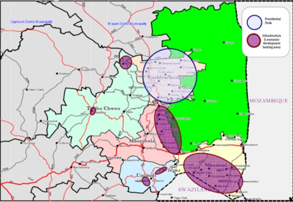
EDM - Priority Areas for Basic Services
Categories of land use in Ehlanzeni District

The land use patterns of urban or rural areas are mostly influenced by a diverse set of factors, which include climate, topography, and resource base in the area such as minerals, soil types, water availability, and biodiversity (Daniel and Hopkinson, 1989).
The land cover of Ehlanzeni district is dominated by forest and woodland, and thicket bush as shown above. Forestry, agriculture and other activities such as tourism are the result of the moderate climatic conditions of Ehlanzeni. Ehlanzeni is a low rainfall area (mean annual rainfall is 350 to 700mm), characterized by flat terrain at low altitude as well as highly to moderately dissected mountains terrain, characterized by steep valleys and gorges that form part of the Escarpment.
Ehlanzeni District is also rich in terms of its biodiversity and mineral resources. Gold mines are operating at Barberton and Pilgrim's Rest and chrome mines at Lydenburg. The future development of the Eastern Limb of the Bushveld Complex directly west of Lydenburg will also have an influence on the future land use patterns within the Thaba Chweu Local Municipality.
The Biodiversity within Ehlanzeni also plays a significant role in terms of boosting the tourism industry with the Kruger National Park as one of the major destinations for international and domestic tourism. Tourism, like agriculture, is among other land use patterns, which uses land extensively because of the availability of natural resources.
The land use patterns discussed in this section include agriculture, mining, forestry, industrial and tourism. The Ehlanzeni area is dominated by agriculture, forestry and tourism as the main freight economic activities/generators characterising the land use pattern of the area.
The municipality is predominately rural with most developments taking place around the urbanised areas. Local municipalities face a number of challenges with regard to land ownership because most land is either under the authority of traditional leaders or belongs to private individuals. Further challenges to the land issue are the finalisation of land claims which hinders developments across the entire district on areas earmarked for development. The municipalities require the implementation of a proper land use management system for the whole municipal area to resolve mushrooming of informal settlements in all the urban areas of the district. Traditional leaders need to be effectively consulted and engaged in addressing the land use management issue.
With an estimated average annual growth rate of 2.38% per annum for the 2001-2006 period, this translates to an estimated increase in population of at least 23,000 each year. The impact of this growth will have an impact on the provision of housing, social and freight services in the district and hence will require timely planning. The list below highlights the spatial and freight transport challenges posed by population growth in the district.
Freight Transport challenges posed by the district's population growth include:
- Continued sprawl of settlements particularly in Mbombela east (Nsikazi) and Nkomazi south and Bushbuckridge.
- Challenges of spatial transformation of dormitory settlements that are far from work places and other economic activity centres.
- Pressure on the land for residential purposes and the competition with subsistence or commercial agricultural activities.
- Increased need for housing while addressing land tenure upgrading - formalisation.
- Pressure on the rural development programme to absorb increased size of the potential labour force.
- Increased need for infrastructure - water, sanitation, roads, schools and community centres.
- Increased need for service provision i.e. water, sanitation, electricity, transport.
- The fact that land ownership is mostly in the hands of private individuals.
The location of Ehlanzeni presents a strategic position and a number of freight transport growth and development opportunities within an international, regional and Southern African context. The existing spatial development initiatives in the region are of critical freight transport development importance to the district namely, the Maputo Development Corridor Spatial Initiative, the Tourism and Biodiversity Corridor and the Limpopo Trans-frontier Park.
The Maputo Development Corridor
The Maputo Development Corridor provides Ehlanzeni specifically Mbombela with the status of economic development node. The Corridor runs from Witbank in the Eastern South African province of Mpumalanga, through Nelspruit, to Maputo the capital of Mozambique. Investment targets the provision of infrastructure, agriculture, mining, energy, chemicals, tourism and manufacturing sectors.
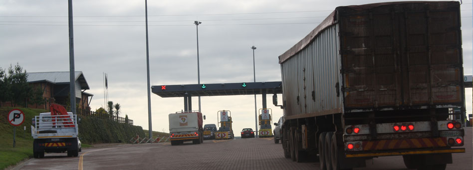
The key infrastructure projects are the N4 Maputo Corridor toll road, the upgrading of the railway line from Ressano Garcia to Maputo, the upgrading of the Maputo Port, the dredging of the harbour and telecommunications. The transport axis between Gauteng, the industrial heart of South Africa, and Maputo offers the shortest link to an export harbour.
The Nelspruit- Phalaborwa SDI
The main road link will run from Phalaborwa to Nelspruit in the Mpumalanga province, where the SDI will join the Maputo Development Corridor. The corridor aims to create better access between the port of Maputo and the mining potential around Phalaborwa in Limpopo Province. The following incentives also support the SDI:
- The Bushbuckridge Local Municipality has been declared as an ISRDP (Integrated Sustainable Rural Development Programme) Node, which prioritises the area for special development incentives and funding from the National Government
- The Kruger to Canyons Biosphere, which links the Blyde River Canyon with the Kruger National Park.
The Limpopo Trans Frontier Park
The Kruger National Park is the largest game reserve in South Africa and covers some 20,000 square kilometres. It extends approximately 350 kilometres from north to south and approximately 60 kilometres from east to west. To the west and south of Kruger Park are the provinces of Mpumalanga and Limpopo. In the north is Zimbabwe, and to the east is Mozambique.
The Kruger National Park is now part of the Great Limpopo Trans-frontier Park (with a total area of 35 000 square kilometres). This peace park links Kruger Park with Gonarezhou National Park in Zimbabwe, and with the Limpopo National Park in Mozambique. Other areas of incorporation are Manjinji Pan Sanctuary and Malipati Safari Area in Zimbabwe, as well as the area between Kruger and Gonarezhou, the Sengwe communal land in Zimbabwe and the Makuleke region in South Africa. The Park is part of the Kruger to Canyons Biosphere, an area designated by the United Nations Education and Scientific Organisation (UNESCO) as an International Man and Biosphere Reserve. The Giriyondo Border Post between South Africa and Mozambique is provided north of the Ehlanzeni boundary with Limpopo.
The Tourism and Biodiversity Corridor
The Tourism and Biodiversity corridor includes parts of south-eastern Mpumalanga, northern Swaziland and southern Mozambique, which are closely associated with the Maputo Corridor Spatial initiative. It adds a further dimension to the Maputo corridor in the sense that it promotes the utilisation of the undeveloped tourism development potential in rural areas that house the poor communities. It also coordinates and integrates with agricultural-led developments forming part of the Komati River Basin Development programme. These initiatives span over international boundaries and are managed by international agreements. Although some of these initiatives are still in a very early stage of implementation they pave the way for regional as well as local development strategies and should be thoroughly taken into account in all levels of integrated development planning. Accessibility within the district and region needs to be enhanced to enable the optimal application of private and public investments.
The regional and international accessibility of Ehlanzeni provides it with the necessary thrust to become an active role player in the SADC and global economy. The challenge with regard to local spatial planning lies in the utilisation and provision of social and engineering infrastructure in a manner, which will support the above initiatives and enhance the comparative advantages of Ehlanzeni within the region.
The district developmental intentions as informed by the provincial and district spatial profiles and priorities have strong resonance in freight transport development and growth management. The development priorities hereunder support four crucial components that will underlie sustainable development in the district. Focus is therefore on the need for basic infrastructure and development for the poor, economic growth and development, environmental conservation and improving livelihoods as set out in the principles of the Mpumalanga Provincial Spatial Framework. These priorities guide decision making with regard to spatial development and arrangement of, within and between settlements, investment and development spending in the Ehlanzeni District.
» Priority 1An integrated functional urban and rural system focusing on the development of a system eradicating the dysfunctional spatial system that was created during the pre-democratic period, must be developed. The dysfunctional system resulted in areas of severe poverty, limited economic opportunities, limited land tenure options, limited social and engineering infrastructure being far removed from employment opportunities and economic growth. The development of this system will go a long way in the alleviation of poverty.
Spatial integration of displaced settlements with areas of economic opportunity and potential within the Ehlanzeni District will focus on:
- provision of investment opportunities and accessibility to development corridors.
- provision of housing within reasonable distance to enhance accessibility to economic and employment opportunities, and social facilities.
- integration of the natural environment into urban areas
- provision of a range of social, economic and recreational opportunities in nodes or along development corridors.
- promoting local economic development initiatives, attracting economic development to existing impoverished areas.
Focus investment on localities with greatest economic potential emphasising on investment needs on those areas providing the best opportunities to better quality of living of all the residents in the Ehlanzeni District. Currently, the main areas with higher levels of economic potential are Nelspruit, White River, Hazyview, Malelane, Lydenburg, Barberton and Sabie. These areas having higher levels of economic potential attract greater intensity of investment in higher density development forms and provide a greater range and diversity of investment types and supporting services needed to accommodate a greater mix of income levels and activities. These neighbourhoods should provide for different types of housing for different income groups; ownership of productive facilities for all the inhabitants in the neighbourhood; and different choices for people at different life stages and with specific needs addressing the needs of a range of residents of the neighbourhood.
» Priority 3Development of areas with high development needs but low levels of economic activity; focusing on investment in areas such as Bushbuckridge, Eastern Mbombela, Southern Nkomazi, Leroro, Matibidi and Moremela. These are areas where there is a dire need to improve the quality of living through the provision of commercial and infrastructure services, efficient engineering and social infrastructure development nodes that will act as a catalyst for restructuring and renewal of urban and rural areas.
» Priority 4The development of sustainable settlements in rural areas that is, all areas outside areas of higher concentration of people and activity with specific development and settlement needs focusing on the balance of resources on which development is based, and providing differentiated needs of settlement types i.e. agri-villages; mine towns (Lydenburg, Umjindi, Steelpoort and Orighstad); resort development; low density rural residential; eco estates and golf estates.
» Priority 5The responsible use and management of the natural environment required by balancing the use of resources for infrastructure development and operation with the carrying capacity of ecosystems. In areas of high priority with high levels of economic and sustainable livelihood potential which need development, high environmental sensitivity overlap and more detailed planning at local scale will take place. The protection and preservation of not only the Kruger National Park as an international nature reserve but also the provision of managed buffer zones within the adjoining municipal areas form part of spatial development.
» Priority 6Human Resources Development by recognising that spatial restructuring will not occur if development of the people does not occur. This will require the development of people through skills development programmes and access to knowledge of opportunities especially in areas of low economic activity and livelihood potential. The provision of education and training facilities within areas with a high development need and low levels of economic activity and low livelihoods potential is thus a high priority.
» Priority 7Land Reform which includes land restitution, redistribution and tenure reform plays a major role in providing a sustainable socio-economic development of the disadvantaged communities. The severe lack of access to land for the poor can be addressed through implementation of appropriate policies for restitution and land availability in order to accommodate the need of poor for tenure and ownership. The Nsikazi, Nkomazi, Bushbuckridge, Leroro, Moremela, Matibidi areas need to be prioritized through the District and Department of Land Affairs strategy.
» Priority 8Enhancing regional accessibility in order to develop the full potential of all the development nodes within Ehlanzeni. The spatial structure will be provided with the aim of enhancing inter municipal and intra municipal accessibility.
The National Spatial Development Perspective (NSDP) serves as a spatial planning framework for meeting government's objectives of economic growth, employment creation, and sustainable service delivery. The NSDP is based on the premise that the reconstruction and development of South African society should include the reconfiguration of apartheid spatial relations. This requires an acknowledgement in development planning of the existing and changing spatial patterns of population settlement, economic development and general potential.
The NSDP provides a framework for future development of the national space economy by reflecting localities of severe deprivation and need, of resource potential, of infrastructure endowment and of current and potential economic activity through descriptions of key social, economic and natural resource trends and issues shaping the national geography. It acts as a common reference point for national, provincial and local governments to analyse and debate the comparative development potentials of localities in the country by providing a coarse-grained national mapping of potential.
Government is committed to economic growth, employment creation, sustainable service delivery, poverty alleviation and the eradication of historic inequities. All infrastructure investment and development spending programmes should therefore support these objectives. In order to meet these objectives in the most cost-effective, sustainable and equitable way, it therefore becomes imperative that the principles of the NSDP are used as a guide by all spheres of government for spatial planning.
The NSDP objectives and principles are critical in the development of IDPs and the Provincial Growth and Development Strategies. The NSDP principles seek to ensure that investment in infrastructure and development programmes supports government's growth and development agenda. They provide concrete mechanisms that guide spatial planning between the three spheres of government to ensure synergy of government programmes. The NSDP is not a plan but a framework that should be guiding spatial planning between the three spheres of government. The draft Spatial Development Framework of Ehlanzeni was thus developed on the premise and understanding that it seeks to promote and advance the NSDP principles and values at both the district and local levels.
NSDP objectives and principles.
Flowing from the NSDP are the following normative principles used as a guide by all spheres of government when making decisions on infrastructure investment and development spending:
- Economic growth - a prerequisite for the achievement of other policy objectives, key among which would be poverty alleviation.
- Expenditure on fixed investment - beyond the constitutional obligation to provide basic services to all citizens (such as water, roads, electricity as well as health and educational facilities), focusing on localities of economic growth and/or economic potential in order to attract investment, stimulate sustainable economic activities and create long-term employment opportunities.
- Addressing past and current social inequalities - focusing on people not places. This aims at creating a balance of exploiting the potential of localities with high levels of poverty and development potential through fixed capital infrastructure; and localities with low development potential and government spending, government should focus on providing social transfers, human resource development and labour market intelligence.
- Overcoming spatial distortions of apartheid - future settlement and economic development opportunities should be channelled into activity corridors and nodes that are adjacent to or link the main growth centres. Infrastructure investment and development spending should primarily support localities that will become major growth nodes in South Africa and the Southern African Development Community region to create regional gateways to the global economy.
The NSDP principles therefore provide a sound basis for the freight development, growth and management in Ehlanzeni District. The principles are clearly expressed in terms of local government key performance areas, district priority initiatives and objectives contained in instructional documents such as the Ehlanzeni District, IDP & CITP for example. To achieve service delivery, economic growth, poverty alleviation and job creation will require the alignment of freight efforts and resources.
The Mpumalanga Provincial Growth and Development Strategy (PGDS) defines the provincial future development trajectory by providing a strategic provincial freight transport development framework. It further aligns the provincial freight transport intent and action to national government goals, frameworks, strategies and policies such as the Vision 2014 of the MDGs, AsgiSA, and NEPAD.
The objective of the PGDS is to facilitate a freight transport cooperative, developmental and coordinated policy (intent) and strategy (action) framework to address poverty and sustainable development. The policy and strategy objectives of the PGDS are to give effect to the principles of a freight transport developmental state; facilitate and support sustainable development; promote and support economic growth and development; facilitate and provide essential services in social and human development; and focus on transversal priorities.
The provincial growth and development agenda of Mpumalanga is underpinned by four thematic areas namely poverty reduction, job creation, economic growth and development, and environmental sustainability. Poverty Reduction is focused on addressing the disproportionate levels of poverty that exist amongst the population of the province. Poverty reduction in the province has not changed in the last decade and will require government freight transport interventions among other interventions which will alleviate the living conditions especially of people or households without income or living on grants. Job creation will focus on reducing the absolute unemployment level in the province. The province needs a well-educated and skilled freight transport population which can change the freight transport economic trajectory and uplift the socio-economic situation of the province.
Freight Transport economic growth and development will be achieved through private sector investment and activity. Provincial government will be required to facilitate and promote a sustainable economic environment that is conducive for business investment through regulation, provision of public infrastructure and employment programmes.
Freight transport environmental sustainability will need the protection and advocacy by provincial government in conserving the natural heritage of the province without industrialisation and development having a major impact on the environment. Globally, the environment is at a major risk with warnings of global warming and climate change, shifts in environmental patterns causing floods and earthquakes.
PGDS priorities and areas of opportunity are thus summarised as follows:
- Using indigenous resources to create jobs - recognising that agriculture and tourism sectors have the potential to create and employ large numbers of relatively skilled workers, including the low-skilled in Mpumalanga. This will include land reform and restoration processes, targeting small farmers, environmental rehabilitation and ecotourism, heritage and culture, and exploration of biofuel opportunities.
- Supporting the industrial and freight service sectors to create jobs - to accelerate changes in the provincial economy towards one that is more inclusive and equitable needs support and diversified economic sectors with potential to create jobs such as ICT; agriculture and forestry beneficiation; mining; energy; construction; transport; trade, finance and community services. This will also be achieved by strengthening institutional relationships among state agencies, and regional cooperation with neighbouring provinces and countries.
- Reducing the impact of poverty through social services - due to low levels of formal employment opportunities in the province as a result of the current level of economic growth requires support and targeting poverty relief initiatives, allocation of grants to qualifying individuals, families or households, and exploiting job opportunities through programmes such as EPWP.
- Enhancing social cohesion and developing human capital - by targeting electronic communication, state procurement policies and the informal sector; introduction of transversal initiatives such as developing and improving the training and education sector in the province; investing in specialised and technical skills required in the economy; providing security and safety; targeting sports and recreational facilities to create an integrated and cohesive society.
- Strengthening sustainable development - through sustainable use of the environment. This priority targets environmental economics, environmental planning and education, protection of biomes, water management, renewable energy, pollution and land use management systems.
- Maximising the provincial benefits from the mining and energy sectors - through beneficiation of mineral and natural resources while mitigating any environmental impact.
- FreighTransport governance and spatial integration - the need for a highly skilled workforce at all levels of service delivery in government; ensuring that spatial and integrated development planning takes place at all three spheres of government; strengthening of monitoring and evaluation, policy making and alignment of provincial priorities.
These priorities form part of key sector strategies which Ehlanzeni is continuing to develop. Consultation and participation by sector departments during the IDP review process becomes critical to ensure that the PGDS gives effect to the freight transport development agenda of the province. EDM is therefore seeking to strengthen cooperative governance with sector departments to ensure integration of PGDS priorities into the IDP processes.
The District Roads Master Plan was concluded in May 2009 with the aim of assisting in integrating and coordinating the planning and implementation process followed by the various parties involved in roads infrastructure, and to address the links between them.
Public transport routes within the area of jurisdiction that had priority consisted of district roads, bus / taxi routes and major access roads. The process of identifying roads for assessment were done by means of highlighting the routes which provide access to schools, clinics, places of worship, cemeteries, police stations and places of public interest.
The roads hierarchy development was tested against various future development scenarios, based on information from the IDPs of the local municipalities in order to determine the most effective road hierarchy. In order to obtain an indication of the type of work and cost required to rehabilitate the existing roads infrastructure, fieldwork and visual assessments were carried out on selected routes and the existing roads were further classified in order to record their status.
A total of approximately 6245km of roads within the EDM's area of jurisdiction was assessed. Information pertaining to their locality, road names, ownership, surface types and condition, road width, adequacy of storm water related structures and an upgrading/maintenance cost estimate was captured and compiled for each road. On average, approximately 74% of the gravel roads and 30% of the surfaced roads in the various Local Municipalities require re-alignment and reconstruction, as well as maintenance and base failure corrections respectively.
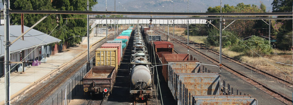
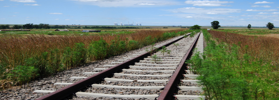
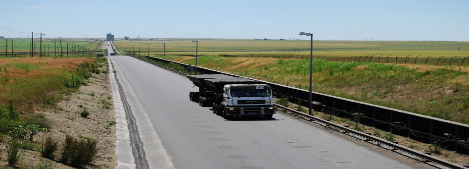
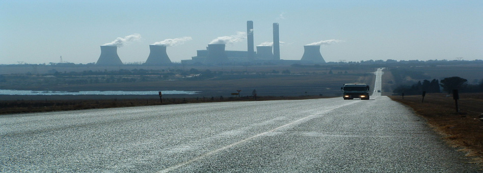
EDM has a well-developed road network. However, the roads in rural areas are predominately of poor condition which are gravel, and in some instances partially tarred. Most of the tarred roads are not well maintained. Residential streets in rural areas are not tarred and make accessibility difficult during rainy seasons. Another type of transportation within the district is the rail network which transverses the entire district along the N4 Maputo corridor to Komatipoort and to the north along the R40 to Phalaborwa. The current railway system does not serve commuters between their places of employment and home. Majority of commuters either use buses or taxis between their places of work and home or getting to any other destination.
The bus sector is more formalized and reliable in the entire district carrying more than 85% passengers on 500 routes, with 139 terminals and 338 buses for BUSCOR and 15 for Great North Transport. The taxi industry is semi-formalized and unregulated and unreliable accounting for less than 20% of the commuters with about 1200 registered vehicles, four Taxi associations and 165 metered taxis.
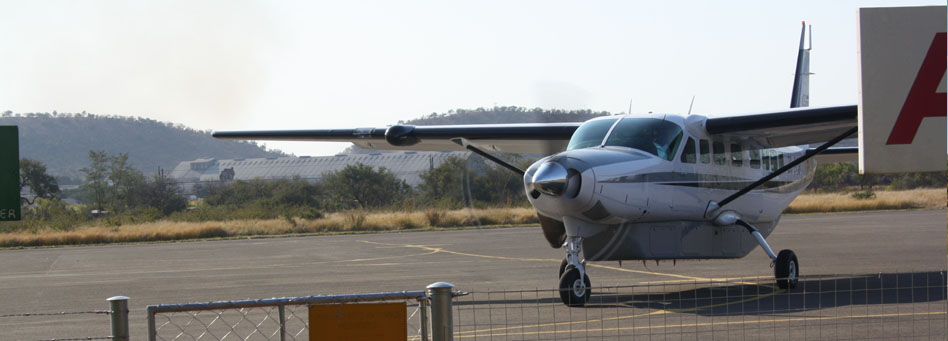
The district has an international airport the KMIA and the Nelspruit public airport. The Malelane, Skukuza and Mhalamhala private airports also serve as other mode of transport links in the District. The district developed an integrated transport plan funded by the Provincial Department of Roads and Transport. The tables belowshow the length of roads in all the local municipal areas of jurisdiction and the length of all the provincial and national roads in the EDM area (Source: EDM Current Public Transport Record 2007)


EDM embarked on developing a Roads Master Plan for its area of jurisdiction in order to determine the state of roads with the intension of identifying and prioritising roads in the rural areas. The Ehlanzeni District Municipality (EDM) established a forum as part of a consultative process, with representation by officials from the EDM's Technical Services Department, as well as from the various Local Municipalities and the Provincial Department of Roads and Transport in order to follow an integrated approach in the planning and development activities taking place in the area for roads.
The roads hierarchy development was tested against various future development scenarios, based on information from the IDPs of the local municipalities in order to determine the most effective road hierarchy. In order to obtain an indication of the type of work and cost required to rehabilitate the existing roads infrastructure, fieldwork and visual assessments were carried out on selected routes and the existing roads were further classified in order to record their status.
A total of approximately 6,245km of roads in Ehlanzeni area was assessed, and information pertaining to their locality, road name, ownership, surface type and condition, road width, adequacy of stormwater related structures and an upgrading/maintenance cost estimate was compiled.
On average, approximately 74% of the gravel roads and 30% of the surfaced roads in the various Local Municipalities require re-alignment and reconstruction, as well as maintenance and base failure corrections respectively. In addition, the roads were also classified in terms of priorities (medium/high) for upgrading requirements.
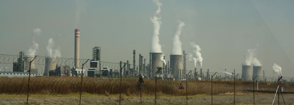
The Ehlanzeni area is dominated by agriculture, forestry and tourism as the main economic activities characterising the land use pattern of the area and constituting the major freight pillars and drivers in the district. Major industrial centres in the area are Nelspruit, White River and Nsikazi. The building, manufacturing and service sectors are boosting freight transport and logistics growth in the Nelspruit and White River areas. These freight generating and development sectors are reviewed briefly in sections that follow.
Agriculture
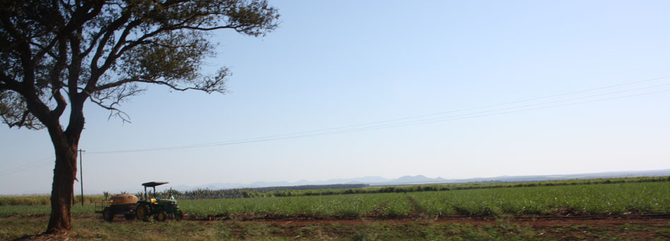
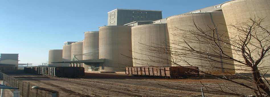
Ehlanzeni District is characterised by a sub-tropical climate, which makes it an ideally suited region for the cultivation of subtropical, citrus and deciduous fruit such as mangoes, litchis, pawpaws, bananas, avocados, guavas, granadillas and tomatoes. Nuts, tobacco, wood and vegetables are other crops grown in the Ehlanzeni area. Agricultural activities compete with forestry in terms of the resource base. The areas of Nelspruit, White River, Barberton and Bushbuckridge form the second largest citrus producing area in the country. The Barberton area is the largest irrigable area, which produces citrus, cotton, tobacco, wheat and vegetables. Ehlanzeni is also well suited for sugar, livestock and game farming.
According to Statistics South Africa's September 2005 labour force survey, Agriculture was the fourth highest formal employer in the province constituting 11.5% of the province's formal employment. Employment within agriculture grew by close to 1% between March 2004 and March 2005 and it is hoped that this reversal in the trend of shedding jobs in this industry will continue.
Mining
Most of the province's gold is produced In Ehlanzeni district, mainly in the Barberton, Lydenburg and Pilgrim's Rest areas. The five mines operating in the Barberton area are: Agnes, Fairview, Consort, Makonjwaan Imperial open-cast and Sheba. The sector has contributed in the past decade to between 17-26% of the Provincial GDP.
The years 2000 and 2001 were peaks as mining increased sales due mainly to the weaker rand/dollar exchange rate and higher demands on the global market especially for platinum. The rich gold deposits have been mined and sold on the export market.
Opportunities exist within mining as follows:
- Growing demand on the global market for commodities (platinum, gold, and chrome);
- Beneficiation of minerals (e.g. Umjindi Jewellery making);
- Platinum Group Metals mining along the eastern limb of the Bushveld Complex (Reef extends from Limpopo to Mpumalanga through Thaba Chweu);
- Chrome: Ferrochrome for steel production as well as export;
- New entrants to mainstream industry for Black Economic Empowerment (Mpumalanga Mining Energy Preferential Procurement Initiative);
- Small Scale mining;
- Strategic alliances for share acquisition through Broad Based Black Economic Empowerment;
For these to be achievable, investment and skills development, technology and infrastructure, as well as broadening of the supplier base, will need to be addressed. Due to the increased mechanization of mining activities, there has been an overall decline in growth of jobs within this sector. Rand volatility of late has not made things easier. The lack of diversification within the industry has led to a mainly commodity export driven industry.
Forestry
Forestry in the Ehlanzeni area dominates the land use and is an important contributor to the economy. Large-scale forestation is found throughout the district with the important areas in Mbombela, Pilgrim's Rest, Sabie and Graskop. There is also direct competition between forestry and agriculture, but in most cases, the forested land is steep or rugged and not suitable for agriculture.
Manufacturing And Agro-processing
Mpumalanga is ranked fourth in terms of Manufacturing, behind Gauteng, Western Cape and KwaZulu Natal. It accounts for 7-10% of South Africa's total manufacturing. According to Statistics South Africa's September 2005 labour force survey, manufacturing was the second largest formal employer in the province. Traditionally, the Petro-chemical industry in Gert-Sibande, metals in Nkangala and Agro processing related manufacturing in the Ehlanzeni District, are the main drivers for manufacturing in the province.
The manufacturing sector in Ehlanzeni was the main contributor towards the gross value added (estimated at 24%) in 2005. This was followed by trade (21%) and community services (21%). The timber and pulp/paper manufacturing as well as fruit and sugar processing in Ehlanzeni district has room to be complemented by innovation in furniture design as well as diversification in fruit processing and export growth in processed products via the Maputo harbour or the Kruger Mpumalanga International Airport should the cargo terminal become a reality.
Barriers to market entry for new industry players (e.g. fixed long term contracts within value chain) will need to be tackled in a non-disruptive manner. The human element of laying the foundation for innovation is also an area which will need to be addressed.
Tourism
The tourism sector in Ehlanzeni district is an important source of foreign revenue. Tourism activities are concentrated around the beautiful areas of Pilgrim's Rest, Blyde Rivierspoort, Sabie and Graskop. Furthermore, Ehlanzeni has large conservation areas, which dominate the land use pattern in the east and which include the Kruger National Park, provincial, community and private game reserves.
Tourism in Mpumalanga Province has grown steadily since 1994 contributing an estimated R5.5 billion towards the provincial GDP, but has shown marginal decline in the first half of 2005 in comparison with the same period in 2004. There is evidence to suggest that the good development of our neighbours in Mozambique is eroding the need for them to go across the border in search of items to purchase as these items become more readily available in their own country. There is therefore a need to develop innovative approaches to recapture this core market of our tourism industry. (Source: South African Tourism, 2005)
Economic Growth
According to the Development Bank of South Africa (DBSA) the community services economic sector was the largest economy of Ehlanzeni which made up 25% of the economy. This was followed by manufacturing (22%); Trade (20%) and agriculture sector (9%). Nelspruit is the capital city of Mpumalanga, and is the administrative city of government and some of the large national businesses and corporations.
Job Creation
Trade is the largest employer in Ehlanzeni followed by community services, agriculture and manufacturing in that order. The trade sector increased its employment rate by 4.8% (98,940 to 106,036). The construction sector increased the number of employment opportunities by 33.3% (20,841 to 27,785). The financial sector improved by 12.7%, making it the second highest employer. The government employs more people in the province more than any other business, which makes it the main contributor to the community services sector.
The Maputo Development Corridor
The Maputo Development Corridor (MDC) is an initiative that was undertaken between the South African government and the Mozambican government in 1995. The broad primary objective of the Corridor was to rehabilitate the core infrastructure, i.e. road, rail, border post, port and dredging of the port, thereby re-establishing key linkages and opening up under utilised economic development opportunities of both countries. The implementation of these objectives was divided into three objectives, namely:
- The Primary Phase which focused on the rehabilitation of the existing infrastructure
- The Mega Project Phase which dealt with the establishment of big industries and other large initiatives, basically promoting trade and investment, job creation and economic growth in both countries.
- The Linkage Programme Phase which focused on economic activities aimed at bringing the previously disadvantaged communities into the mainstream economic activities spurred by the Corridor.
With regard to the primary phase, projects identified are at different stages of development. The projects on rail, freight, border post and the port are however still lagging behind. The Mega Phase Projects are also at different stages of Development. The major challenge lies in the Linkage Programme Phase. The Anchor projects never took off the ground due to different constraints, which involve, inter- alia, non-cooperation from TRAC on certain economic initiatives, lack of funding and weak institutional arrangement. However, in the main, most of the Maputo Corridor Development initiatives were constrained by the slow movement with regard to infrastructure development.
Given that the Maputo Development Corridor is still key to economic development of both countries, it is imperative that momentum is increased towards the realisation of the set objectives of the Corridor.
The provincial freight transport related flag-ship programmes which are very significant to the EDM strategy are the Maputo Development Corridor; Water for All; Heritage, Greening of Mpumalanga and Tourism because of their nature and what they seek to achieve in the developmental context of the district.
The Maputo Development Corridor Flagship Programme
The Maputo Development Corridor Flagship, one of the "big five" freight transport related flagship programmes identified by the Mpumalanga provincial government, aims at anchoring key government priorities in economic growth, service delivery, environmental sustainability, skills development, and improving institutional systems and processes.
The Corridor cut across Mpumalanga Province from the South West (Gauteng Province) to the East (Maputo province in Mozambique) and covers a 50km radius. The geographic space served by the Maputo Corridor covers one of the most industrialised and productive regions of Sub-Saharan Africa of which Ehlanzeni is well positioned to benefit from in terms of local economic growth and development. EDM will give effect to the objectives of the provincial strategy on the Maputo Development Corridor by:
- Initiating, contributing and participating in the rehabilitation of the primary infrastructure network along the Maputo Corridor - including road and rail links between South Africa and Maputo, the border post between the two neighbours and the Maputo Port;
- Facilitating investment in the corridor area, and through infrastructure development would facilitate social development and create employment opportunities and participation of historically disadvantaged communities;
- Enhancing job creation (permanent and temporary) and sustainable skills development and transfer;
- Creating opportunities through sustainable procurement (Green procurement, BBBEE, Youth Women etc); and
- Improving relations with communities, private sector bodies and development partners.
The Heritage, Greening of Mpumalanga and Tourism Flagship Programme
The overall goal of the Heritage, Greening Mpumalanga and Tourism flagship project is to ensure preservation of the heritage (cultural and natural) and the environmental resource base of the Province and to optimise the socio-economic development through the promotion of sustainable tourism. The general scope of this particular flagship programme is defined by the following three components:
- Heritage research, planning and custodianship through the recording, transformation and preservation of the Province's cultural and natural heritage in a way that promotes the diversification and expansion of tourism.
- Greening Mpumalanga through application of spatial planning principles in the management of the natural environment, and by ensuring a clean and healthy environment for the people living in and visiting the Province, and creating environmental awareness by advocating for sustainable environmental practices.
- Tourism sector diversification and expansion by harnessing the cultural heritage and natural resource base in order to drive sustainable economic development, job creation and poverty alleviation.
- Ehlanzeni will give effect to the objectives of this flagship programme by:
- Facilitating and/or implementing projects that transform and preserve the natural and cultural heritage of the district;
- Including issues of management of the natural environment through the greening programme during spatial planning of the district;
- Optimising the tourism potential to facilitate economic growth, sustainable development and job creation in the district;
- Ensuring a clean and healthy environment to the people living in and visiting the district by advocating environmentally sustainable development; and
- Creating awareness of the importance of efficient usage of cultural and natural resources to ensure a "good life" for future generations.
In responding to the freight transport orientated flagship programme, Ehlanzeni contributed to the development of the Ehlanzeni Cenotaph in recognition of provincial political heroes in 2008. The district will be implementing its tourism strategy during the 2009/10 financial year. The district has plans of developing an Environmental Management sector plan when resources will be made available.
The main purpose of the Ehlanzeni District Municipality Disaster Management unit is inter-alia to implement appropriate disaster risk reduction measures to reduce the vulnerability of communities and infrastructure at risk. Ehlanzeni District Municipality is primarily responsible for disaster management within its area of jurisdiction. In order to fulfil its primary mandate, Ehlanzeni District Municipality needs to adhere to the National Disaster Management framework, Provincial Disaster Management framework and the Disaster Management Act. Council has adopted the District disaster management framework with the following key performance areas and enablers, namely:
- Institutional Arrangement and Capacity as part of the establishment of the disaster management centre
- Disaster Risk assessment
- Disaster Risk Reduction
- Response and Recovery with respect to the need to establish early warning systems.
Local municipalities are in the process of establishing satellite disaster management centers that will also link through the information management system. Ehlanzeni District Municipality is responsible for conducting district education, training, public awareness and research needs and resources analysis including freight transport. The process is ongoing and includes all stakeholders and communities.
Crime in the municipal area is quite problematic and unacceptable. There are a number of social factors affecting the communities that have resulted in the increase of crime in the municipal area. Lack of adequate police stations and capacity within the existing ones has had a negative impact on the safety and security of the communities. The most highly reported crime cases in the district are property related at 17.3% followed by social fabric types of crime at 7.4% and lastly violence related crimes at 2.3%. An average 41021 number of people is served by one police station in the district and one police official serving 1000 people (ISDF, 2006). This ratio does not take into account other constraints like human resources and other related resources.
The National Crime Prevention Strategy (NCPS) was launched in Mpumalanga on 20 January 2000. A Multi Agency Mechanism (MAM) at the Provincial level was established as a consequence of a resolution adopted at this launch. Subsequently, regional structures were established in November 2001. The Provincial Executive of the MAM, through consultation with relevant stakeholders, adopted a set of guidelines for operating the MAM Structures.
The National Crime Prevention Strategy (NCPS) states that effective crime prevention in South Africa requires the development of a shared vision, both at political level and at an inter-departmental level, both vertically and horizontally and is widely as possible within civil society and the non-governmental sector. Such a shared vision must go beyond the simple vision statement by encapsulating a shared understanding of how exactly crime is to be prevented. At the same time, a concerned and co-ordinated national initiative must be based on solid decisions about the most effective way to use resources.
It is upon this brief background that the MAM at District level was instituted. MAM at a Council level is composed of various structures and stakeholders. The idea of a Crime Summit was realised at compilation of the IDP for 2007/2008. This endeavour of a crime summit has been unanimously supported by all structures represented in the District MAM. Subsequently a preparatory committee was established to prepare for the logistics of the Crime Summit.
During the second meeting of the Crime Prevention Summit Preparatory Meeting, 14 August 2007, it was resolved that Ehlanzeni District Municipality will be hosting the Crime Summit as well as the launching of the new slogan "Blow the whistle, Shaya Impempe against crime before 2010 and beyond, siyoyishaya impempe". (Source:ISDF 2006).
Crime has reached an unacceptably high level in certain areas of the district with the Pienaar (Mbombela) area being the highest crime spot in the country. This is attributed by lack of adequate police stations and lack of capacity within the existing police force and inadequate access roads within the District. The lack of street lights in the settlements aggravates the situation and certain environmental factors contribute to the sprawling of crime e.g. un-maintained parks, cemeteries and dilapidated buildings. Criminal activities, including drug trafficking mostly take place in certain areas around taxi ranks and bus terminus. Unoccupied RDP houses are also a challenge as criminals use them as their crime nests.
Copyright © 2010 Mpumalanga Province Freight Transport Data Bank [ - ]
All rights reserved.
This website conforms to W3C Standard [ - ]