Nelson Mandela Metropolitan
Introduction The Nelson Mandela Bay Metropolitan Municipality was established in 2000 by joining the local authorities of Port Elizabeth, Uitenhage, Despatch and several smaller adjacent local authorities into one metropolitan municipality with a new demarcated boundary. The Nelson Mandela Bay Municipality is the only metropolitan municipality in the Eastern Cape. After the Ekurhuleni Metropolitan Municipality in Gauteng it is the second largest metropolitan municipality in area in the country covering an area of 1950 km². According to the 2001 Population Census, the population in Nelson Mandela Bay was approximately 1.0 million. Tentative demographic research being undertaken as part of the refinement of the Metropolitan Spatial Development Framework (MSDF) indicates that the 2001 Census was more accurate than earlier believed and that the current population is still in the region of 1.0 million indicating that there has been very little population growth since 2001. In terms of population distribution, the greater proportion lives in areas such as Motherwell, Ibhayi, Bethelsdorp, Bloemendal, KwaNobuhle and Walmer Gqebera. Only a small proportion of the population, estimated at 28 000 people, live in the peri-urban areas. For forecasting purposes, it is assumed that there will be an annual population increase of 1.9% representing natural growth rate as well as rural-urban migration. Approximately 40% of the Metropolitan’s population is below the age of 20 and 53% of the population is between the ages of 20 and 60.
Manufacturing Industry
The single biggest industrial development initiative within the Metropolitan is the 11470 ha Coega Industrial Development Zone and the deep water Port of Ngqura situated at the mouth of the Coega River. The Coega IDZ is expected, over time, to change the “epi-centre” of industrial growth. The stringent requirements to locate within the zone, the timing of availability of land and the need for other forms of industry in other locations will result in a continued demand for industrial land outside of the IDZ.
Other industrial areas include the following: · Markman – This industrial area primarily caters for the heavier type of industry. Although there has historically not been much demand for industrial land here due to its perceived distance from the city, this is expected to change because of its strategic proximity to the Coega IDZ. · Perseverance – This area has the advantage of being located close to the Ibhayi residential area and thus provides conveniently located employment opportunities. Two large recent developments (SAB and Corning) have resulted in this area being almost fully developed. · Airport – Developed as an area for industries dependent on air transport. The area is underdeveloped and vacant space exists. · Struandale – This is an older industrial area close to labour sources with limited expansion potential. · Korsten – This is an older industrial area with older buildings and smaller industries. · Deal Party – This is an old industrial area and is fully developed. · Uitenhage – Spare growth capacity for expanding the Uitenhage industrial complex exists at Jagtvlakte. Part of the industrial area is being developed for the Auto Cluster as one of the Vision 2020 projects. The Auto Cluster’s focus is to address the needs of the auto industry in order to encourage new automotive operations and the expansion of existing operations. The first project will be a Logistics and Light Assembly Park close to the Volkswagen plant.
Agriculture
A challenge in developing urban agriculture is the availability of suitable land in appropriate locations for small scale farming purposes. This is primarily due to land with the most viable agricultural potential being situated largely within the western segment of the Metropolitan with most of it being in private ownership. It is therefore essential that the ad-hoc subdivision of this agricultural land be controlled so that its agricultural potential is conserved and that the encroachment of urban type development into these areas is contained.
Settlement Patterns
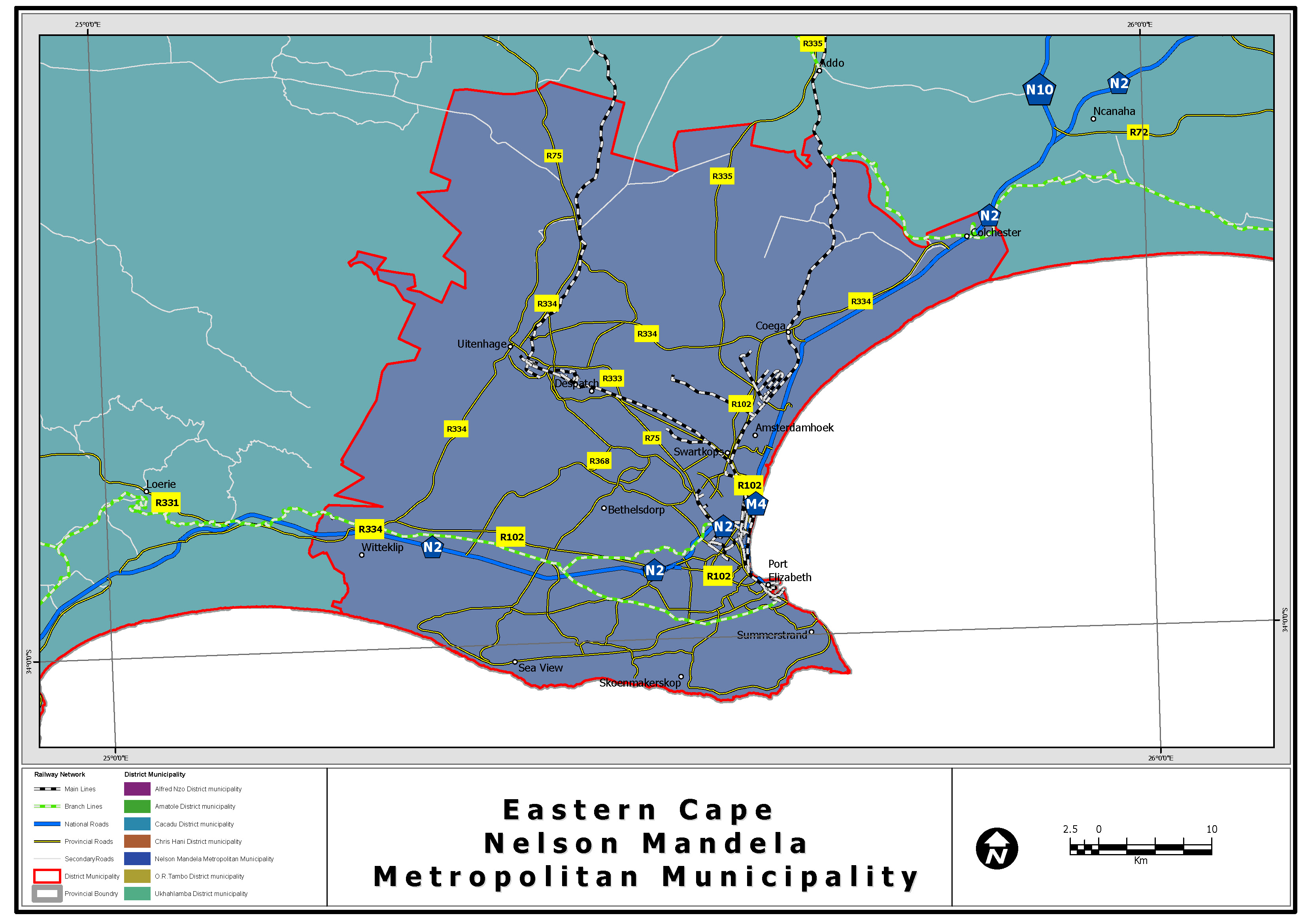
The Metropolitan area covers approximately 1950km² and is spread out over an area that extends approximately 35 kilometres inland and 45 kilometres from north to south. Only half of this area is contiguously developed. The remainder is either not economically developable (due to steepness or location within flood prone areas, etc.) or has not been developed due to ownership patterns or the fact that bulk servicing networks have not been extended.
The rivers and associated valleys that have had the most impact on the existing urban form and transportation routes are the Swartkops and Baakens Rivers. Furthermore, prominent physical features include a wide floodplain south of the Swartkops River and a southern escarpment that rises steeply onto a flat plateau. This southern escarpment is incised by a number of valleys which are of environmental value and which provide opportunity for vehicular access between the low-lying floodplain area and the higher ground to the south. The Port Elizabeth City centre and harbour area have become the focus of all the transportation networks within the region with land use radiating from this central point in a series of sectors.
Topography affected the position of the transport networks with both road and rail staying on level ground as far as possible but also using the breaks in the escarpments and side valleys to provide access between higher lying areas and lower lying areas. These topographic features will continue to affect the manner in which the urban pattern of the region expands, as they will affect the location of land uses and new transportation links. This coupled with the manner in which increased residential densities are dealt with and successfully implemented, will determine the ultimate urban form.
The metropolitan area is characterised by an axis of development spreading from the central city area in a north-westerly direction towards Uitenhage. Approximately 15 - 20% of the metropolitan area can be considered “built up.” The remaining areas are largely undeveloped and comprise small agricultural land holdings, land earmarked for possible future expansion and open space areas.
With regard to residential settlement patterns, the repeal of the notorious “influx control” regulations during the 1990s resulted in extremely rapid urbanization from the rural areas into the city. As people moved into the city, informal settlements established themselves in areas not suitable for residential development and the resultant poor quality of life in these areas became a planning, social and economic issue. The increase in the number of informal settlements is also attributed to the backlog of housing which is estimated to be approximately 80 000 units for lower income groups.
In order to meet this demand, most new residential developments catering for this segment of the market are taking place north of the Swartkops River in Wells Estate and north-west of Motherwell, as well as towards Uitenhage along the Uitenhage Main Road axis. A number of long-standing informal settlements also exist in the peri-urban areas of the Metropolitan. Part of the upgrading plans of the erstwhile Western District Council (now inherited by the Nelson Mandela Metropolitan) was the establishment of properly planned and serviced residential townships in the following areas:
Transport Corridors
The Development of an Integrated Urban Corridor Assessment and Strategy Development Process for Transport Authorities and Provinces report, dated August 2001, prepared for the National Department of Transport provides some guidance on the objectives to be achieved through the development of corridors.
Densification within corridors would require strong co-operation within and across different spheres of government including land-use aspects such as housing, education, health, agriculture, tourism, bulk services, transport infrastructure and transport services.
The Eastern Cape Spatial Development Plan supports the development corridor principles and as such the following prominent development corridors have been identified within the Province:
Khulani Development Corridor
The Khulani Corridor stems from the National Department of Transport’s “Urban Restructuring Strategy” which advocates the integrated planning and development of high density, mixed land use/transport corridors to unify our cities and foster economic growth in previously neglected low income areas.
Korsten, Kwazakhele and Motherwell are three significant nodes in a transport axis in the Nelson Mandela Metropolitan Municipality. Korsten is a developed industrial area on the fringe of the commercial area and is the focus of commuter travel from the surrounding low/middle income dormitory suburbs. Kwazakhele and Motherwell are the two lowest income dormitory suburbs from which bus and taxi modes operate to the Korsten area. Opportunities have been identified in the corridor between Korsten, Kwazakhele and Motherwell to increase housing densities along public transport routes and to create an improved mix of land use around public transport termini which can stimulate economic development in the formal and informal trading sectors. A sum of R2.0 million has already been spent to upgrade bus and taxi facilities in Korsten, Kwazakhele and Motherwell to initiate the process of the reconstruction and development of these areas. Within the corridor the aim of the project is to formulate a spatial development framework and programme to provide transport facilities, higher density housing mixed with commercial developments and other amenities, which will stimulate economic development at identified nodes and enhance public transport usage in the corridor. The spatial framework will be based on the principles for integrated transport and land usage development, which are set out in the Department of Transport’s White Paper and Land Transport Framework. Public transport within the development corridor is to be used as a catalyst to stimulate business development through increased activity and greater accessibility and visibility to passing traffic. This public transport component will need to be integrated with the proposals for improved public transport in the metropolitan area when preparing the Public Transport Plan.
Mdantsane East London Development Corridor (MELD)
The Mdantsane East London Development Corridor (MELD) was identified as an important corridor and focus for future urban development in the East London City Framework Plan (1997).
Development of this corridor will make a significant impact on urban restructuring and urban integration and will serve to focus development at points within the disadvantaged areas along the corridor, which offer greatest opportunities for development and are effective in meeting localised needs.
The following goals have been identified for the MELD project:
The area between Mdantsane and the East London Central Business District Area and the West Bank is included in the corridor. The rail route that passes north of Mdantsane and into the East London CBD has sixteen stations within the defined corridor. The road routes are made up of the R102, N2 Freeway, Mdantsane Access Road, Ziphunzana bypass, the proposed new Buffalo River Bridge and the Settlers Way from the Central CBD to the Chester Road intersection. Public transport has been identified as one of the most important goals in the corridor.
The East London to Umtata Transport and Development Corridor
The East London to Umtata Railway Project is a provincial project with the vision to create an efficient, safe, affordable and accessible integrated transport system in this corridor and in the process initiate an integrated and sustainable growth and development strategy for this region.
A Preliminary Assessment Phase 1 of the project was undertaken during 1998 with the main objective at the time of assessing how an efficient re-activation of rail services on the existing or future rail system could be achieved. The project team concluded that a more detailed study Phase 2 was required to quantify to a greater degree of accuracy the cost/benefits of a revitalized rail service as well as the developmental benefits that should be considered.
A Feasibility Study Phase 2 of the project was undertaken during 2000/2001 and the study embraced, in broad terms a project evaluation of three alternatives defined by comparable bus and car travel times between East London and Umtata of about 5 hours, 3,5 to 4 hours and 2,5 to 3 hours in order to determine which of the three is supreme regarding technical, economic, financial and other key performance criteria including costs and benefits (monetary and non-monetary).
The project team concluded its investigations by February 2001. Corridor development is primarily a municipal initiative but the Department of Transport would support the following strategies:
Road Management
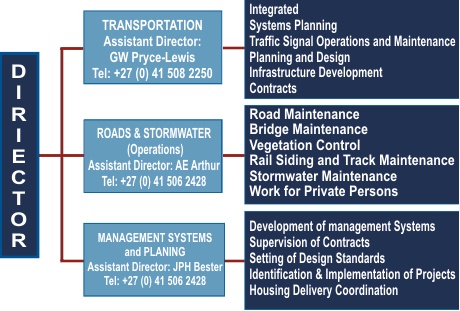
The NMB area comprises 1 950 km² stretching from the Van Stadens River in the west to the Sundays River in the east. The length of the road network in the Nelson Mandela Bay municipal area is 4150 km. Roads are maintained by three roads authorities, namely:
550 km gravel roads
Organisation Structure
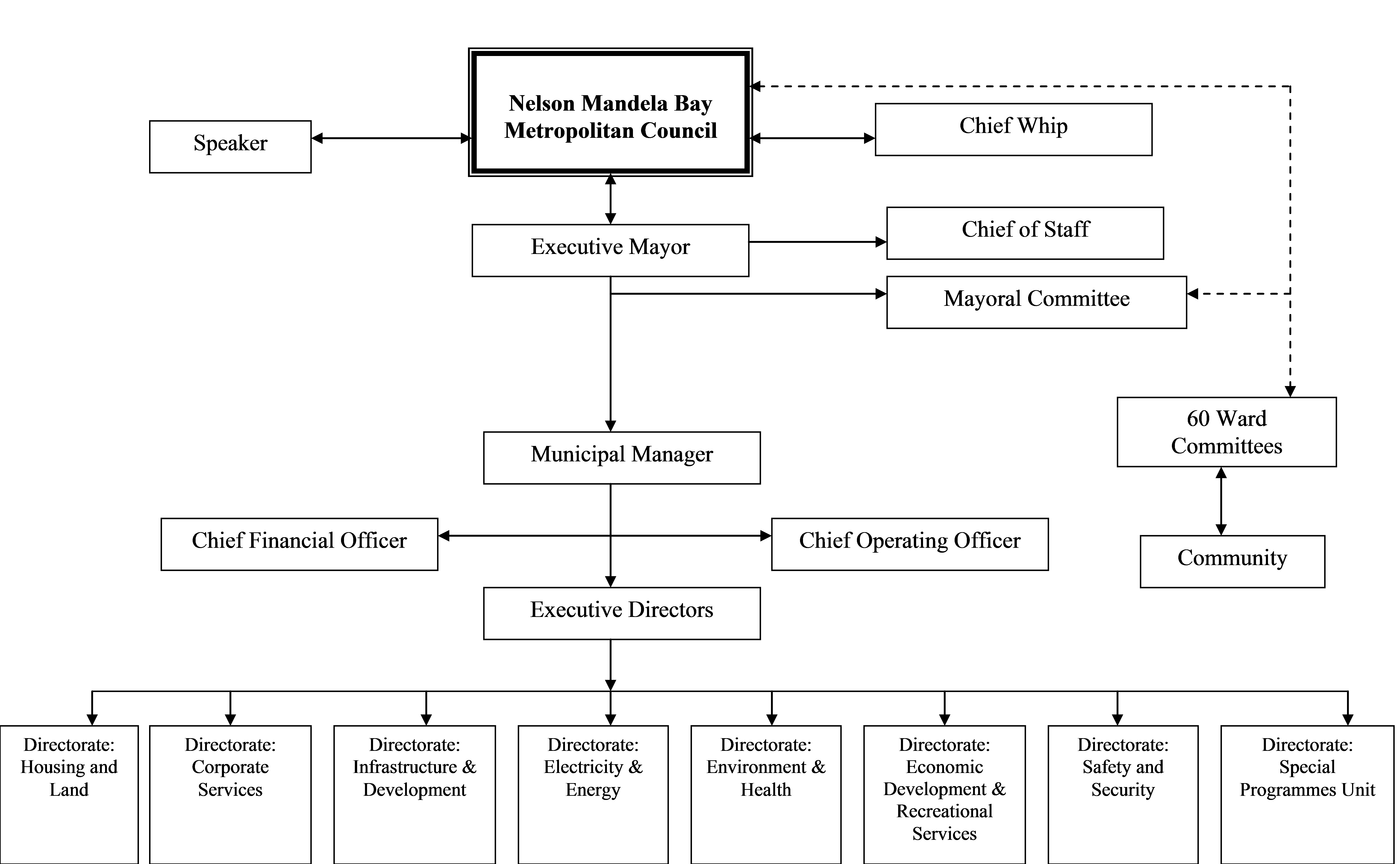
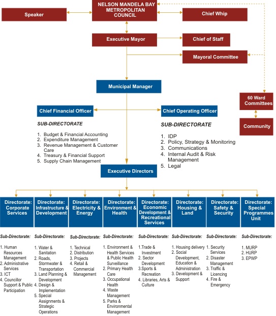
|