Land Use Patterns and Characteristics Major Provincial Land Uses
The Eastern Cape’s entire coastal strip is a key coastal conservation area and includes numerous natural parks, nature reserves, and natural and planted forests. Coastal policies have recently been formulated to obtain optimum benefits from the coast and to ensure its preservation. This relates to a large proportion of the population relying on coastal food sources for subsistence, revenue generating activities at coastal ports, revenue generated from tourism and leisure activities along the coastline, and commercial and recreational fishing activities. Five major tourism/recreation areas have been identified within the Province, namely:
In the northern region of the Province, a key tourism area is the route along the Orange River/Gariep Dam, and the scenic train and road route towards Lady Grey, which forms part of the Friendly N6 tourism route.
The Friendly N6 tourist route extends from East London in the South, northwards along the N6, through Queenstown into the scenic mountain areas of Lady Grey, Barkley East and Maclear. The ski slopes at Rhodes and trout fishing trails are included in this region. An important requirement for the upliftment of the area is the upgrading of access roads between Sterkspruit and Lesotho, Barkly East to Maclear, and Maclear to Mount Fletcher.
The Valley of Desolation, game reserves, mountain hiking trails, Aloe trails and heritage tours in the Graaf-Reinet, Middelburg, and Cradock areas provide an integrated and unique tourism zone, set in the Karoo landscape.
Focused around the historical heritage area of Fort Hare University in Alice and the mountain hiking trails of the Hogsback, Amatola and Katberg ranges, supported by the farming potential of the Keiskammahoek and Cathcart regions.
The entire coastline of the Province, extending over some 800 km, and including the Garden Route to Port Elizabeth in the west, the Sunshine Coast to East London, and the Wild Coast to Port Edward in the east, is a primary tourism and recreation zone.
Manufacturing Industry
In the western region, and in line with strategic investment areas and industrial development zones, most of the major new manufacturing industry is proposed in the Port Elizabeth-Uitenhage area (Nelson Mandela Metropolitan), and new investment is to be targeted to the Coega IDZ. Eskom has proposed the future development of a Nuclear Power Station on a site beyond Jeffrey’s Bay in the western region. This facility is considered of national importance. Major manufacturing is proposed in the Buffalo City industrial areas and new development is targeted to the East London IDZ, which is located adjacent to the Port of East London on the West Bank. Queenstown and Butterworth also have manufacturing industries, although to a much lesser extent. Other areas that have significant service industries include Aliwal North, Kokstad, Cradock and Umtata.
All districts with the exception of Amathole and the Nelson Mandela Metropole have a low location quotient, which means that local needs are not being met by the industry and the regions are net importers of goods and services. These districts do not have a competitive advantage in manufacturing. The Amathole District and Nelson Mandela Metropole both import and export goods and services and they have a competitive advantage in manufacturing. Only the Amathole and OR Tambo districts have a lagging Local SRG which means that the district manufacturing sector grew at a slower rate than the manufacturing sector at a provincial level. All other districts are characterised by faster growing manufacturing sectors than the province. The manufacturing sector in Cacadu, Chris Hani, Ukhahlamba and Alfred Nzo is relatively underrepresented. The sector grew provincially at a slower rate than overall growth, but local growth exceeded provincial growth in the sector. The prospects in the manufacturing sector in these districts are limited by a weak base and external trends. It is recognised that the manufacturing industry is concentrated in East London and the Nelson Mandela Metropole so the weak base in the other districts is expected. In addition, external trends such as the exchange rate influence the growth potential of the sector. Manufacturing in OR Tambo is underrepresented and its potential to contribute towards employment is weak. The sector in this district is limited by external factors, declining competitiveness and has a small base. The sector in the Nelson Mandela Metropole is characterised by high local specialisation. The sector grew provincially at a slower rate than overall growth, but local growth exceeded provincial growth. The manufacturing industry in Amathole (i.e. East London) is an important, but declining, source of employment. The sector in Amathole is limited by external factors and a declining competitiveness. The assessment above clearly indicates that the manufacturing sector is concentrated in the two large urban areas of the province, and all other districts have a weak, underrepresented manufacturing base. However, manufacturing in East London is vulnerable and the trends over the past 8 years indicate that the prospects for employment growth in this sector are low. The Nelson Mandela Metropole is the only region that shows overall future potential for growth in the industry although growth is limited by external trends.
Mining
Mineral deposits in the Province are limited, and mining is predominantly located in the eastern areas. Mining activities include asbestos, clay and sulphur mining in the vicinity of Port St. Johns, coal mining at Indwe, granite mining in the Willowvale area and clay mining around Grahamstown. Deposits of limonite occur in the coastal dunes, but mining of these is subject to strict environmental controls. The minerals industry is therefore very small with a value added of only R179 million in 2000, a fraction a percent of the provincial total.
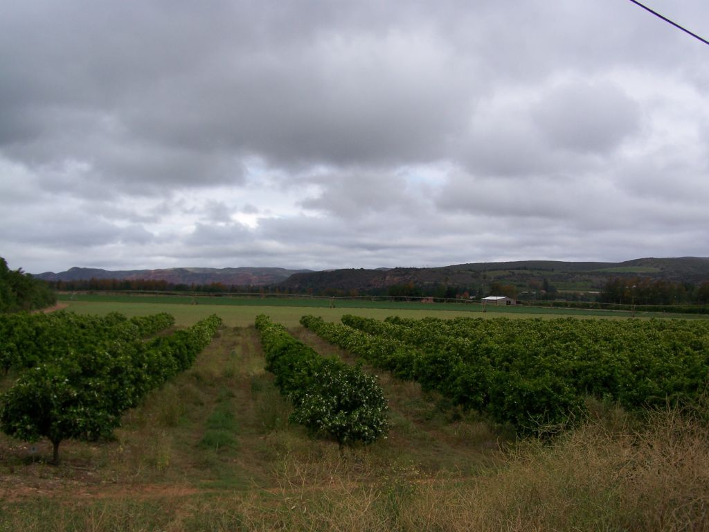
AgricultureWith regard to agriculture and rural development, the Eastern Cape does not yet have a consolidated Rural Development Programme. Current initiatives are focussed on the provision of basic infrastructure, upgrading of roads and stormwater drainage. Agricultural development programmes are currently addressing institutional aspects of capacity building, skills transfer and Farmers Support programmes. In addition, the Community Based Development Planning Project seeks to provide capacity and training to communities wishing to embark on small-scale farming and SMME projects. One of the main advantages of crop farming in the Eastern Cape, especially horticultural crops, is the frost free all year rainfall coastal zone, which extends 10 – 20 km inland. Potential arable land in the province totals 1 172 901 hectors, 7% of the land area of the Eastern Cape. Horticulture is of far more greater importance for the province. The Eastern Cape is a major South African producer of citrus, pineaples, tomatoes, deciduous fruit and tea.
Settlement Patterns
Settlement in the Province has occurred in three primary ways namely, rural, peri-urban and urban. In many instances, the rural-urban character of settlements has merged and it is often difficult to distinguish the differences between them. This is particularly the case in the central and eastern regions, whilst the northern and western areas have more evident differences between urban and rural areas. Informal settlements have tended to develop in all three types, with a greater density of these occurring in peri-urban environments. Accordingly, spatial proposals reflect these differences:
Fish River SpatialDevelopment InitiativeThe Fish River SDI includes significant development opportunities in tourism clusters and nature conservation both along the coast and at inland locations where the Great Fish River Nature Reserve complex and the Addo Elephant Park are earmarked for significant developments incorporating private sector investment. The SDI is also linked through to the historical heritage sites and tourism networks in Alice, the Hogsback, Amatola and Katberg Mountain range areas.
This forms a growth corridor which could extend to Umtata and be linked by secondary roads to the Wild Coast SDI. Umtata and Queenstown are identified as important regional nodes in the SDI which have the potential to develop their commercial and service/administrative economies to a significant degree.
Wild Coast SpatialDevelopment InitiativeThe targeted focus area will build on the unique tourism and recreation opportunities offered at designated nodal development points on the Transkei coast. The extremely high agricultural potential of the Pondoland area in the Eastern region is an important component of this SDI, and offers a wide range of farming and forestry opportunities, together with downstream, value-adding processing and manufacturing opportunities.
Development nodes are identified in the Wild Coast SDI to serve as investment anchors; particularly in the Mkambati-Mtentu area where there is a proclaimed nature reserve and forest reserve, incised by the Msikaba and Mtentu Rivers. The area is also rich in cultural heritage and Tourism Clusters have been initiated using the SMME and community based organisations. Port St. Johns is a resort area with well-known beaches, one of which is situated in the Silaka Nature Reserve. At Coffee Bay and Hole in the Wall, there are unique coastal resorts, rich in natural and geological features; whilst the Dwesa/Cwebe Nature Reserves, located in the southern portion of the SDI area and divided by the Mbashe River, offers enormous resort and eco-tourism potential.
The Wild Coast SDI also includes the hinterland areas of the coast and involves a variety of projects linked to the service centres on the coastal routes, SMME programmes and community based projects in agriculture, industry and tourism. (Source: Eastern Cape Provincial Land Transport Framework (2002) – Provincial Department of Roads) .
|