Alfred Nzo
Introduction
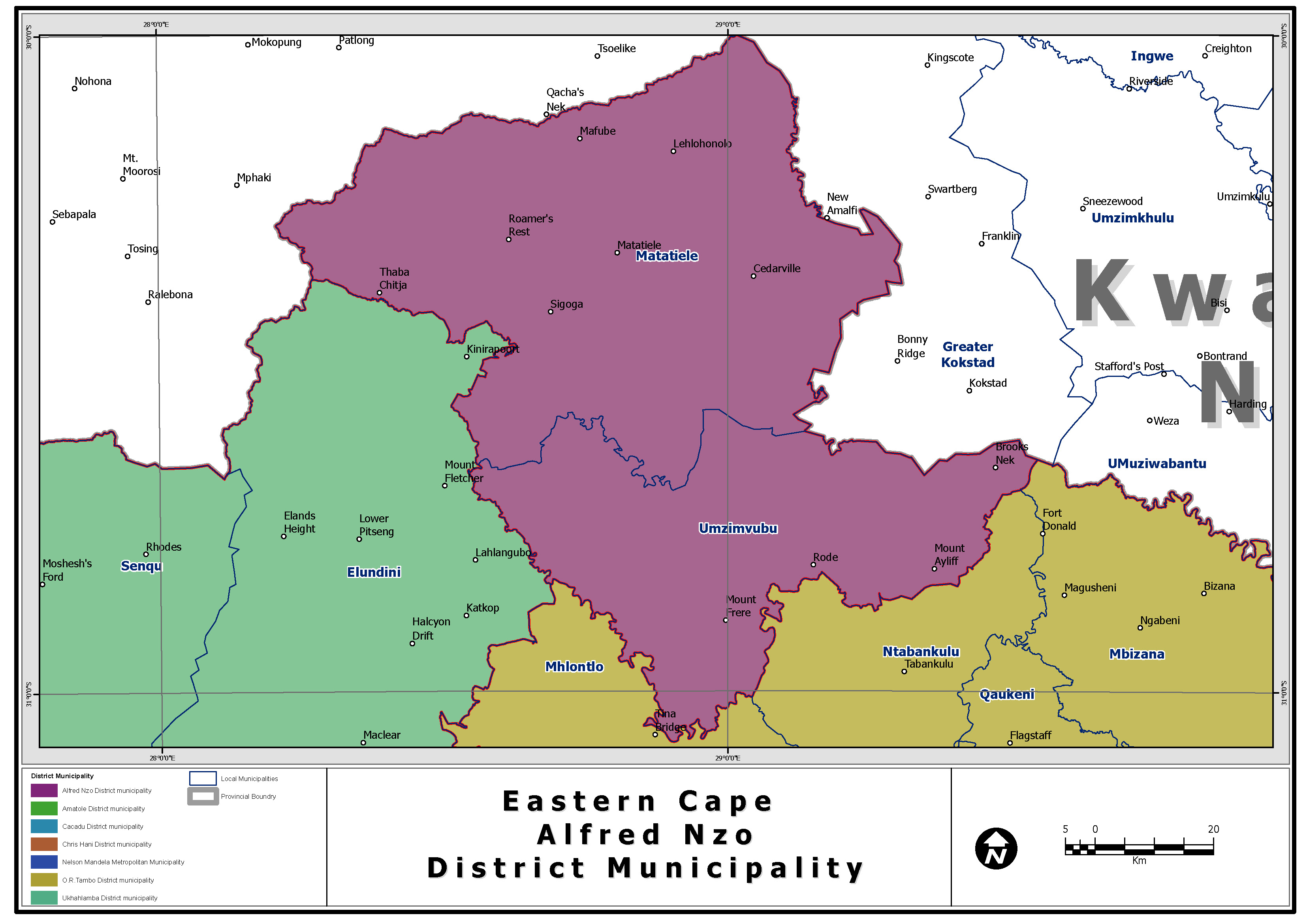
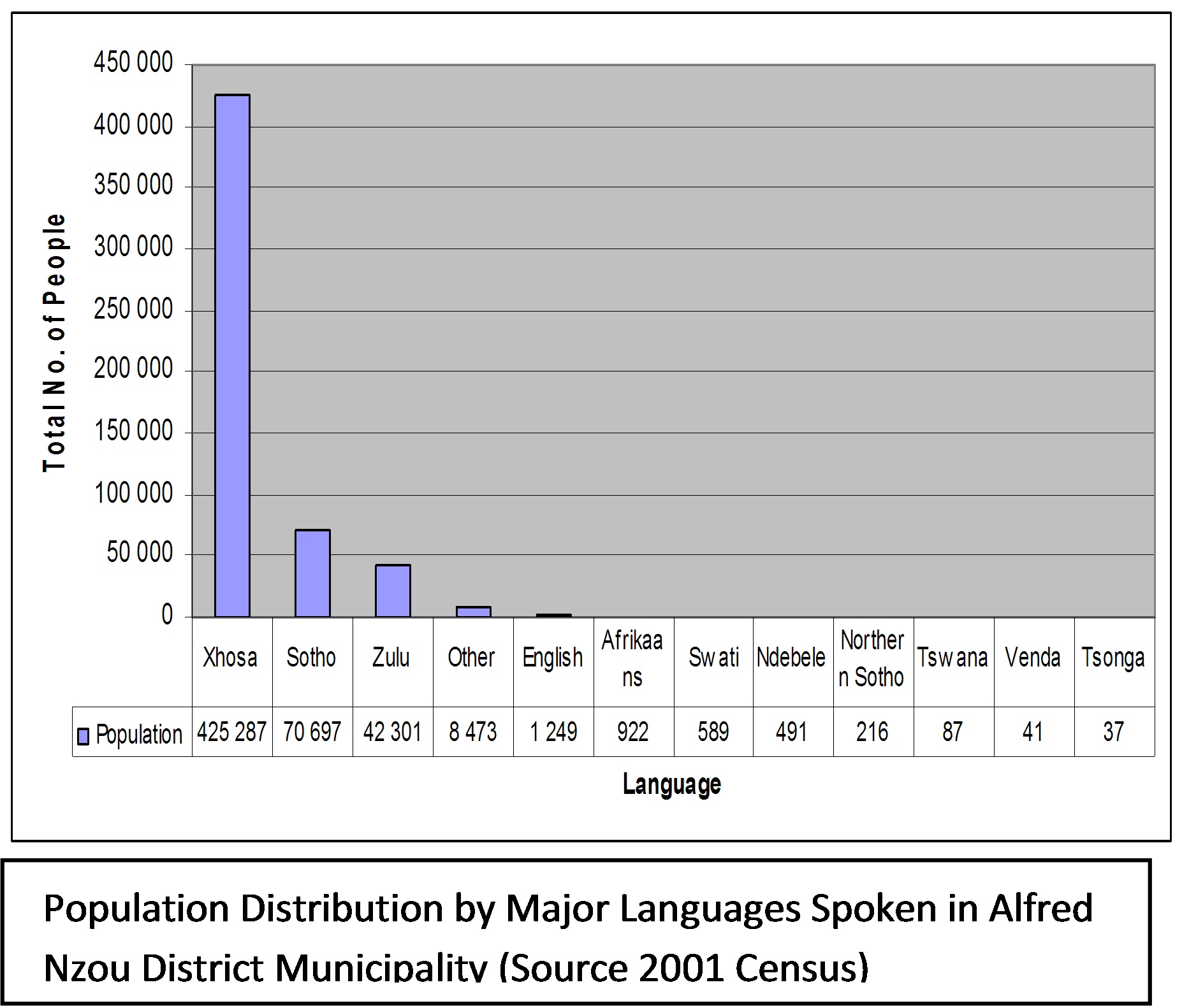
Alfred Nzo District Municipality is located between the O.R Tambo District Municipality and Sisonke District Municipality in KwaZulu-Natal, along the N2 between East London and Durban. The District has a total surface area of approximately 7734 square kilometres. Alfred Nzo is one of the 7 districts of Eastern Cape province of South Africa. The majority of its 550 392 people speak Xhosa (2001 Census). The figure to the left presents Alfred Nzo population distribution by language. The Alfred Nzo District Municipality has these towns under its name: Mount Frere, Mount Ayliff, Maluti and Matatiele. It is the smallest and one of the poorest district in the province.
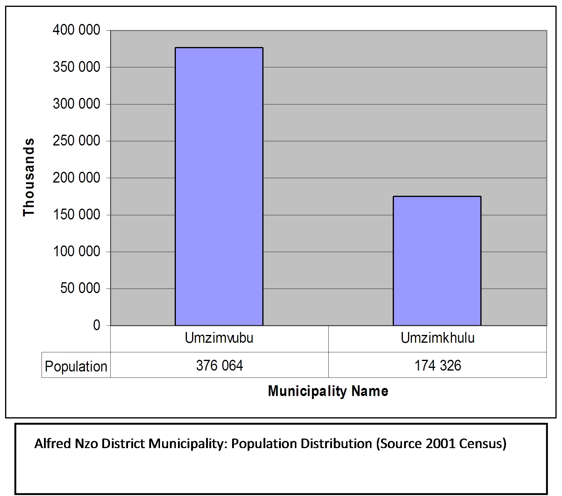
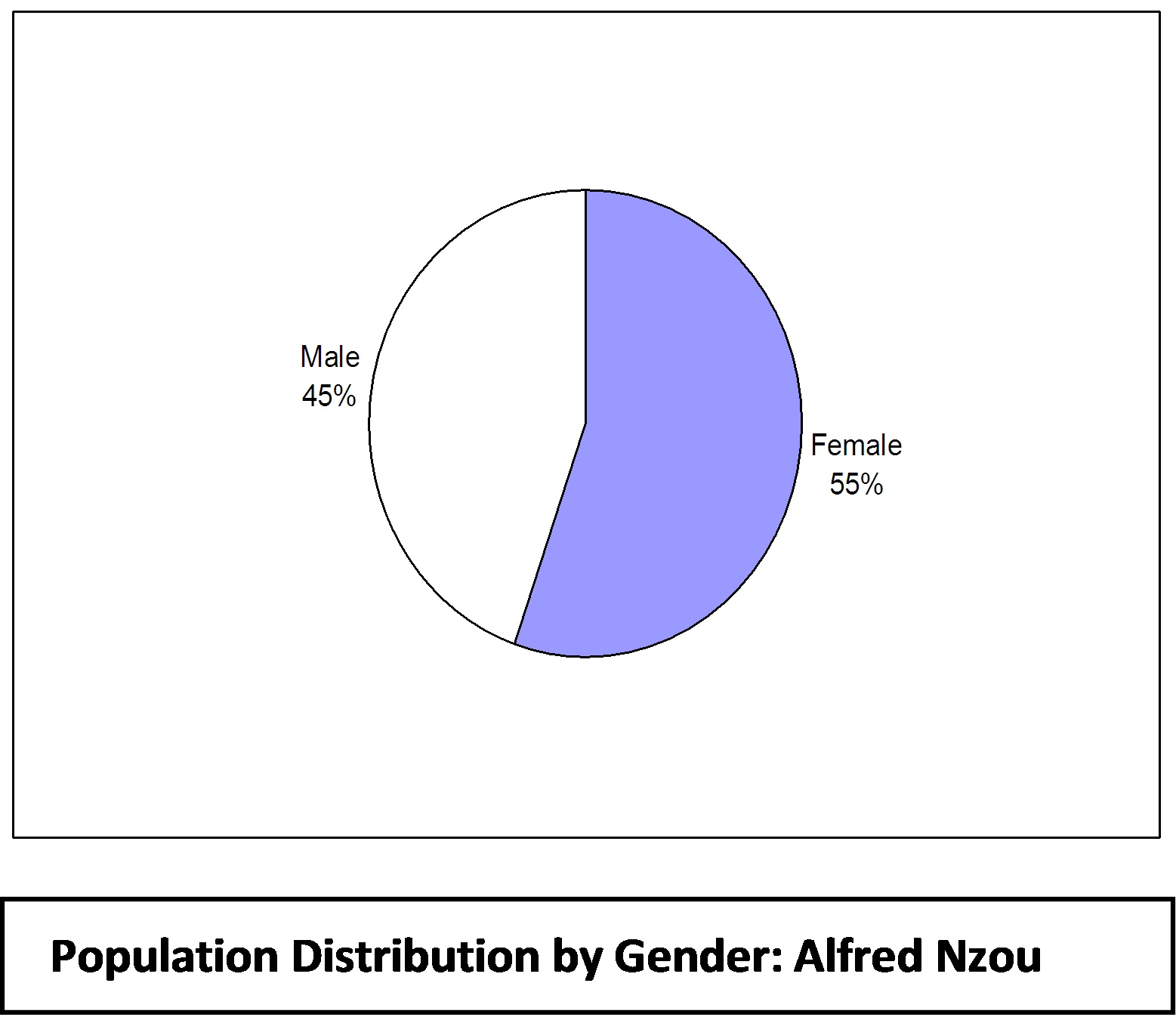
The district contains the following local municipalities: Umzimvubu and Umzimkhulu. The Figures shows that Umzimvubu has 68.33% of the total population in the district population, while Umzimkhulu with 31,67% has half the population size of Umzimvubu. Freight transport activities and movement are also greater in Umzimvubu than in the Umzimkhulu municipality. In conducting freight business in the municipality the need to take account of the local languages for communication is important. By the same token efforts for gender empowerment in freight and BBBEE are important given the gender and ethnic composition in the Alfred Nzo District Municipality as depicted the pie chart to the left. The District has a fairly young population, which may be attributed to high levels of migration and high levels of HIV/AIDS. The government and community sector in Alfred Nzo is the largest employer followed by agriculture and forestry. Manufacturing contributes only 6%5 of employment for the formal economy. Processing of farming, forestry and other primary sector goods is seen as a potential area for growth. The remote nature and relatively unspoilt environment of Alfred Nzo is also noted as a potential asset in diversifying into the eco-tourist market. Alfred Nzo is an ISRDS (Integrated Sustainable Rural Development Strategic Node) and as such several ISRDS projects are being executed in the Alfred Nzo District.
Tourism
The scenic landscape and the inherent qualities of the natural environment offer significant opportunities for the development of eco-tourism. However, the degrading natural environment within the District needs to be managed to prevent further degradation so as to ensure that eco-tourism initiatives can come to fruition.
Agriculture
The District is characterised by large tracts of underutilized agricultural land, which can be utilized for food security and larger scale economic activity. Tracts of forestry within the District, whilst having environmental consequences, could potentially increase economic development prospects.
Settlement Patterns
One of the key constraints confronting the District is the challenge of servicing low-density dispersed settlements. Linked to this consideration is the fact that existing major towns require investment in regeneration and, particularly, in upgrading the public realm as starting points for greater diversification and development.
Road Network Infrastructure
| ||||||||||||||||||||||||||||||||||||||||||||||||||||||||||||||||||||||||||||||||||||||||||||||||||||||||||||||||||||||||||||||||||||||||||||||||||||||||||||||||||||||||||||||||||||